|
Friday, July 19
The AC ran most of the night, and it was 82 and very muggy when we took off at 7:00 a.m . Yesterday we drove over 500 miles even stopping to tour the Custer battlefield and loosing an hour to time-change. Today we knocked off 600 miles by 6:00, leaving less than 386 to get home tomorrow. We pulled into a campground at 6:00 last night at 95 degrees. The inside of the Silvermine was 99 degrees, and it wasn’t going to go down quickly . . . even with the AC going full blast! We had plenty of fans and the air movement helped a lot as we went to bed at 10:00. Saturday, July 20 Our GPS says we will be home at 3:00; I make this 3:30 if we stop to walk the dogs several times. I try to think of something appropriate or profound to say as I end this vacation blog . . . all I can think to say is a tribute to Tom, my personal trip planner! He spends the winter putting together an outline for a trip, and then filling in all the details with route planning and reservations. We never feel rushed applying his itinerary on a daily basis, and we never fail to know what we are doing from one day to the next. We never feel “tied” to a schedule. Because of his seamless planning we are mostly able to stay in State Parks and National Parks or other points of high interest, and to thrill to some of the most iconic highlights and roadways the USA has to offer. EVERY TIME someone asks Tom “how are you doing?” he responds with: “I’m living the dream!” It is one that he carefully crafts . . . and he allows me to tag along!
1 Comment
Wednesday, July 17 We really are on our way home now with just one little bend out of the way to visit Custer’s Battle of the Little Bighorn. I’ve read (and listened) to so many books about this battle, and I have an ongoing affair with Custer. We won’t make it all the way there today, but we’ll knock off enough of the trip that we will arrive tomorrow morning. Thursday, July 18 525 miles yesterday go us to Hayden, MT, just 15 miles away from the Custer Battlefield. The other great news was that the park and Visitor’s Center opened at 8:00. We were one of the first ones there! Since the last time we were here (30 years ago?) the park has undergone amazing renovations due to archeological digs and forensic fact-gathering on the battlefield. We watched the excellent movie, and walked the paved pathways out and around the (fenced in) Last Stand Hill with its markers, the large monument honoring all the fallen soldiers, and the amazing memorial honoring the Indian fighters. We did not do the five mile auto tour leading to the location of the Benteen/Reno stand-off . . . and we did not buy any of the massive number of books written about the battle! 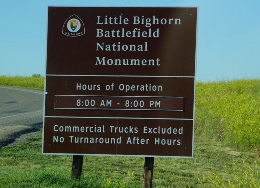 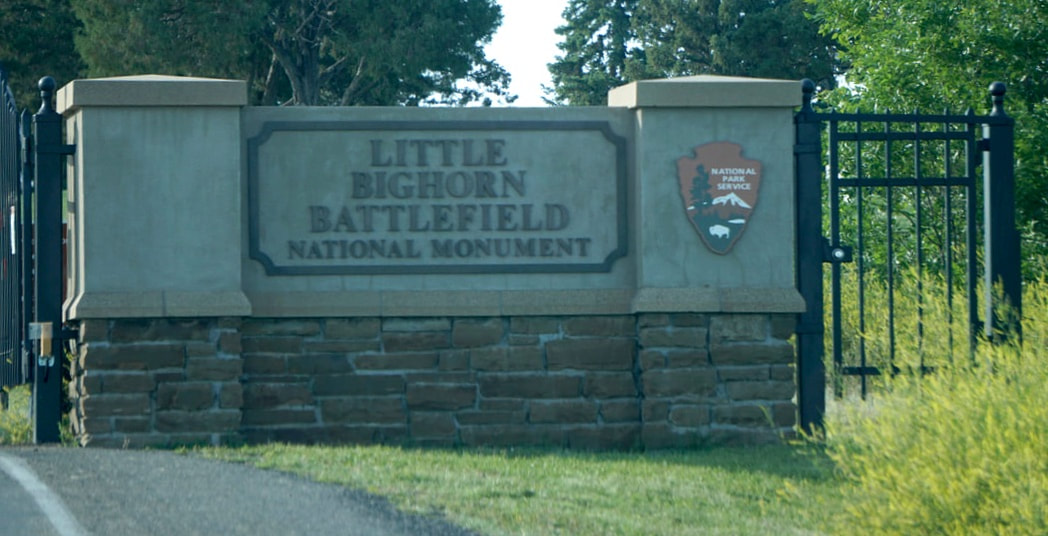 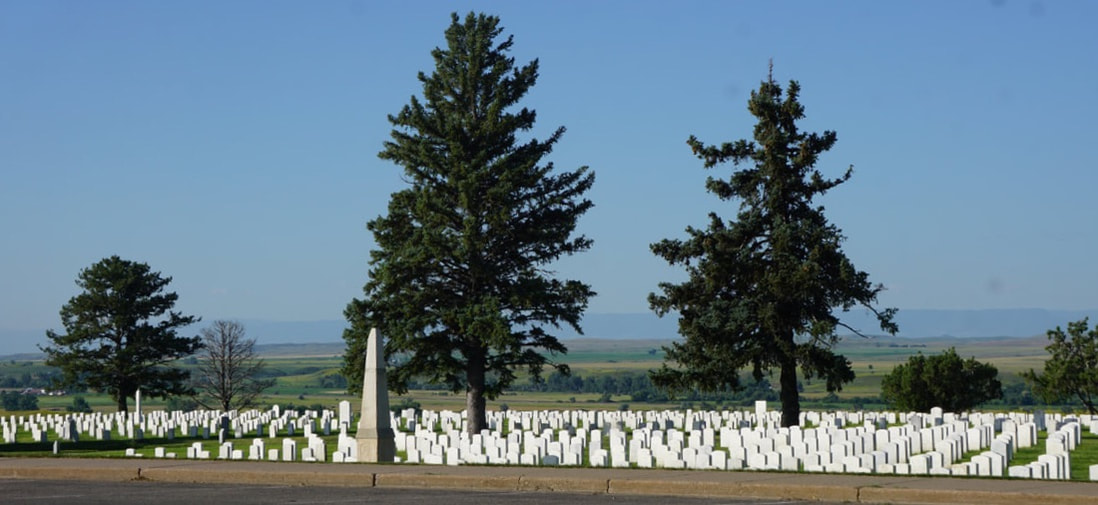 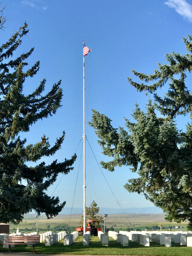 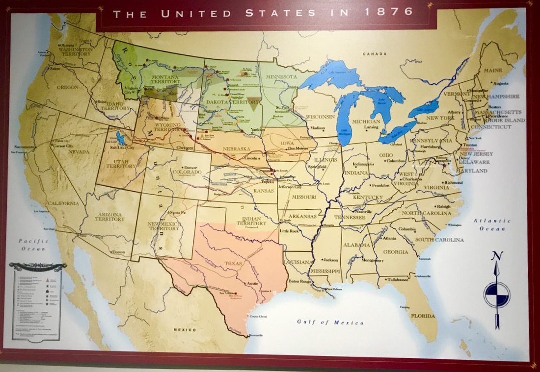 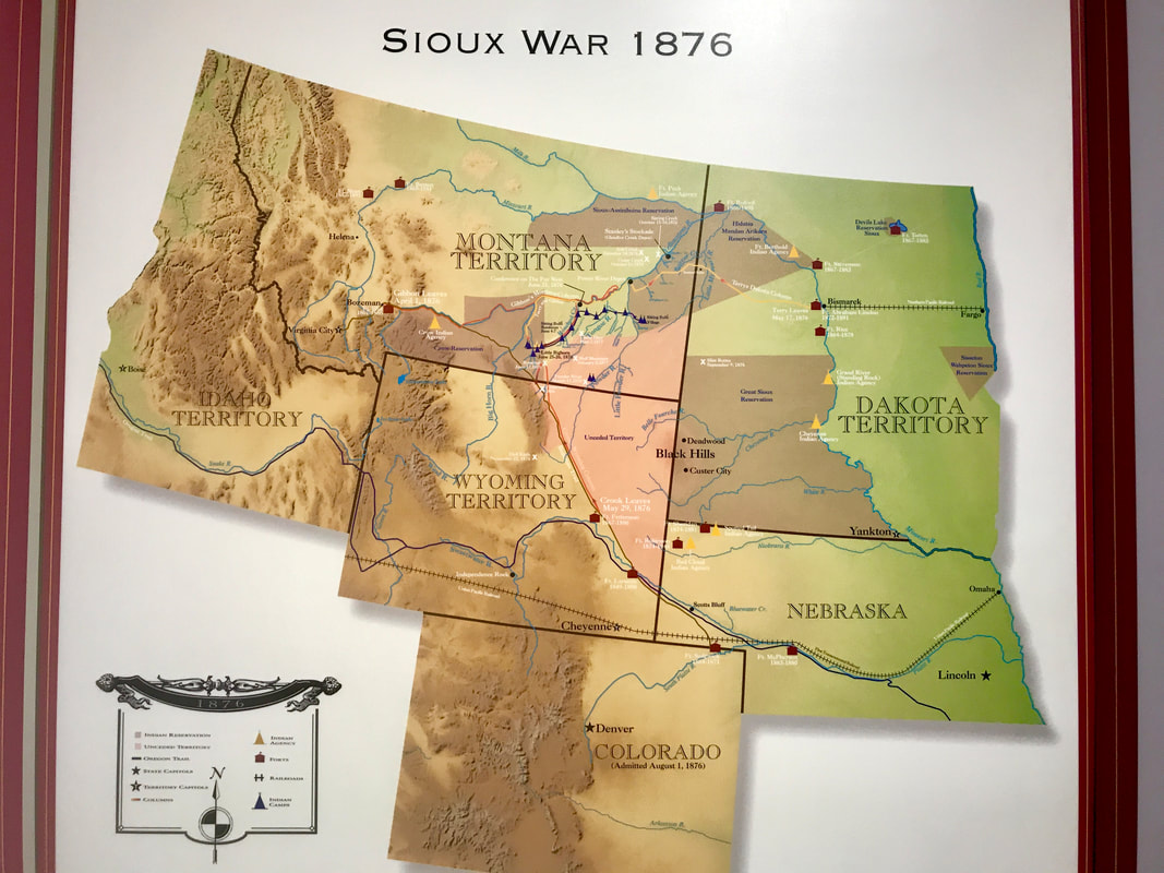   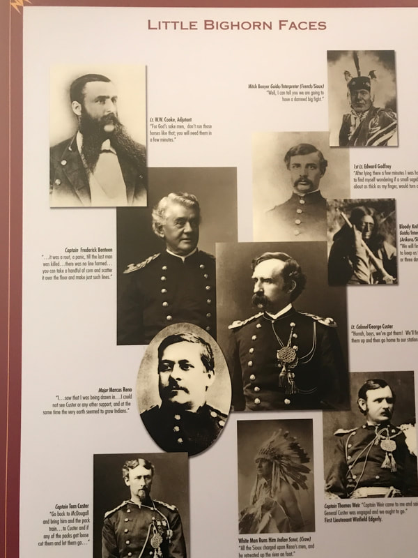 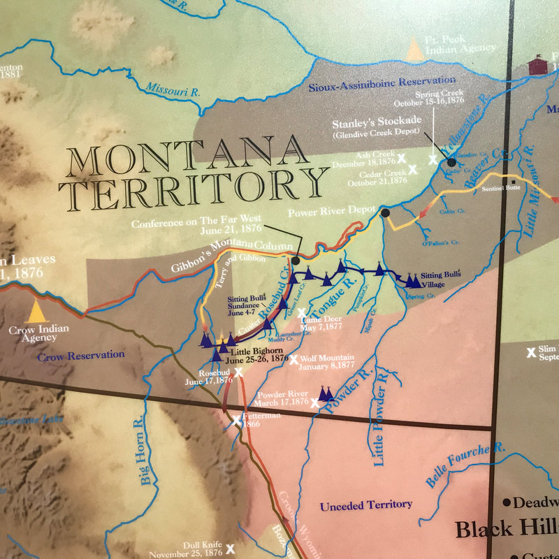 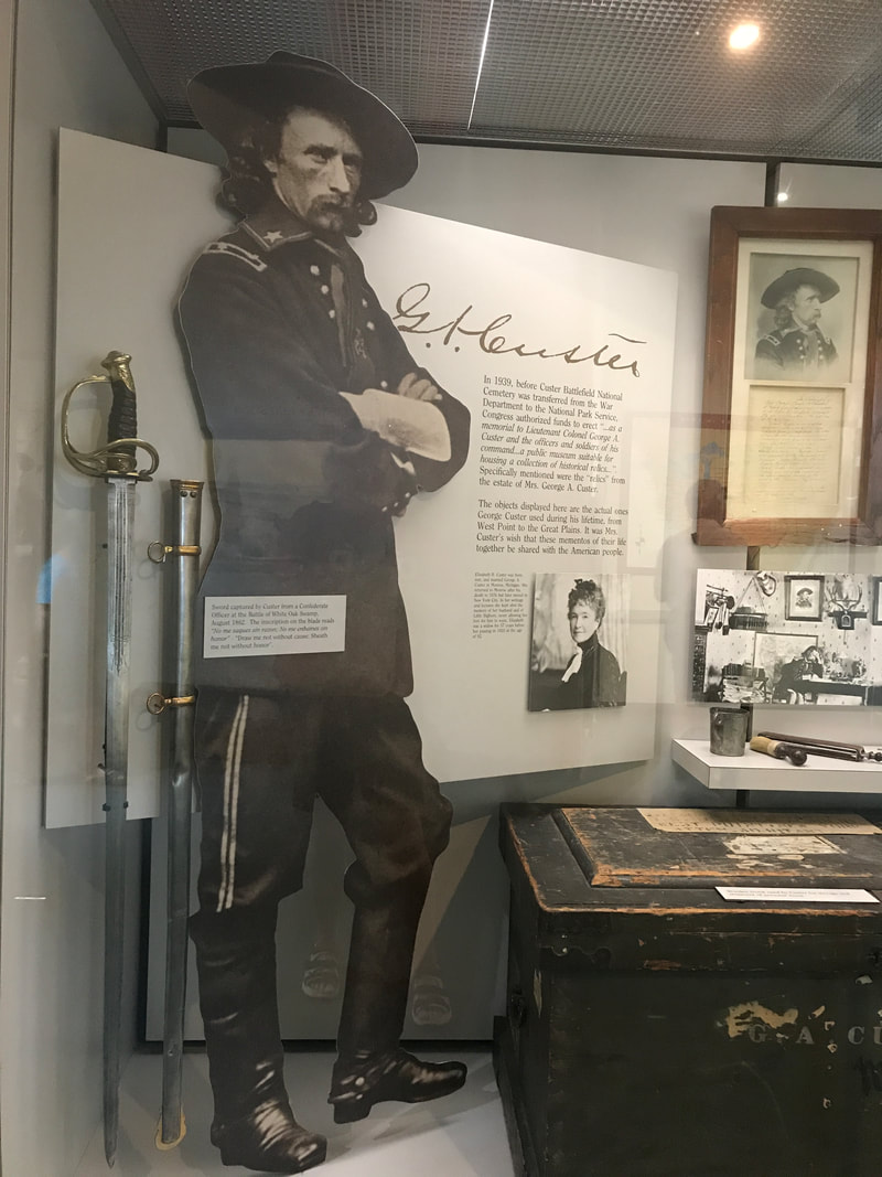  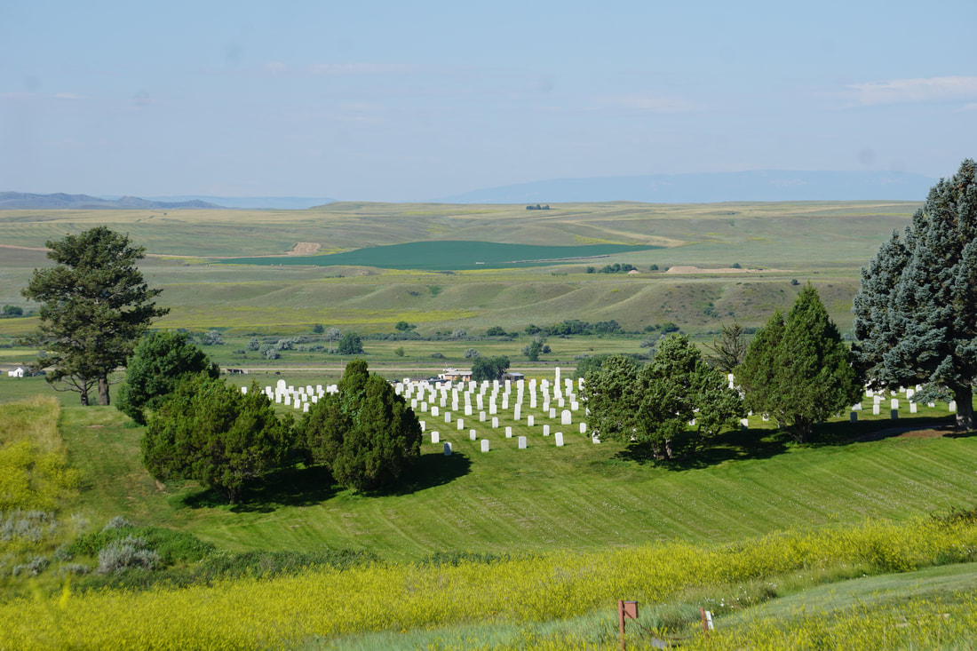 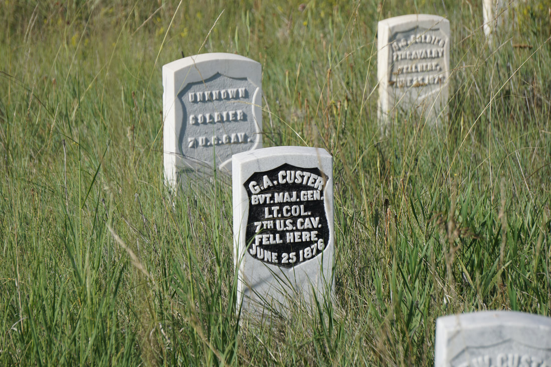  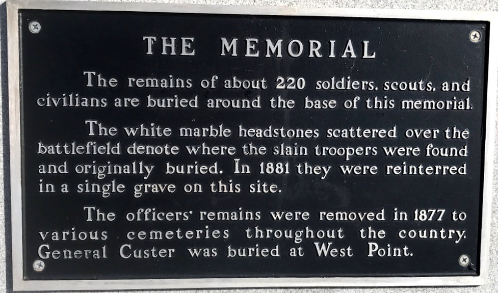  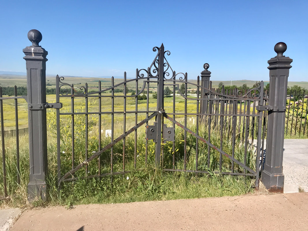 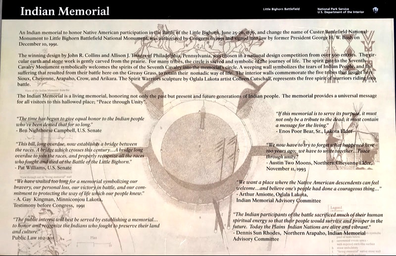 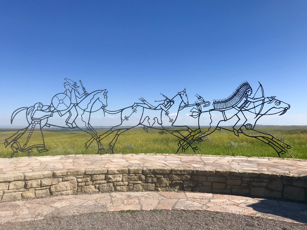 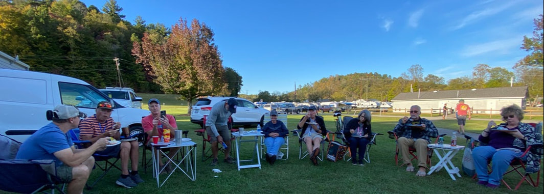   By 10:00 we were on our way . . . home!
We passed some of our favorite outposts on Interstate 90 without even stopping: Devil’s Tower, Custer State Park, Badlands National Monument, Wall Drugstore, Mt. Rushmore, Crazy Horse Monument, Corn Palace. As temperatures climbed to 90, there was not very much incentive to stop for the evening in South Dakota where the campgrounds are just as treeless as the Interstate. A time change took an hour away from us. Finally, we saw a sign for Al’s Oasis Campground. At 7:00 we pulled in, glad that Al’s "Oasis" lived up to it’s name with nicely shaded spots! Tuesday, July 16 This morning’s ride was a scene of many layers: Blue sky breaking through overhead, thick grey clouds capping the mountain peaks, dusky blue/green mountain ranges, white clouds trapped in the lower valleys, healthy tall dark green forest, bright green mountain meadows, diseased forest with straight, grey, naked tree trunks, swift-flowing blue/white Flathead River, and healthy green new forest. Twenty miles of it . . . all the way to Polebridge. 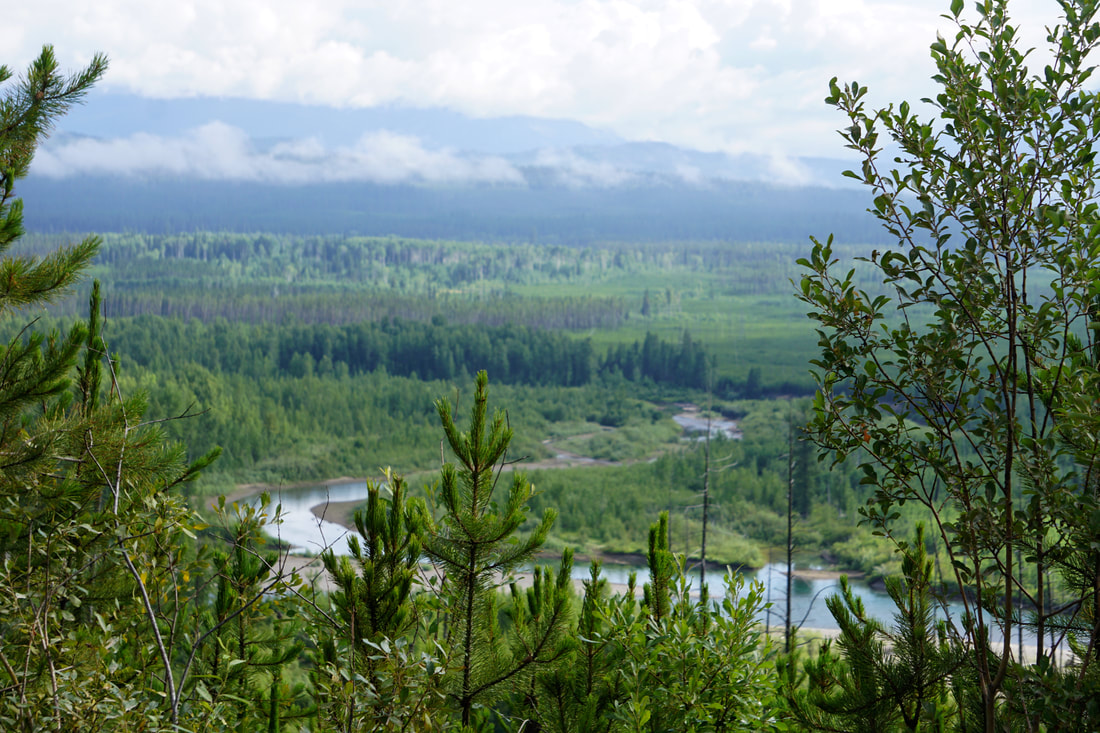 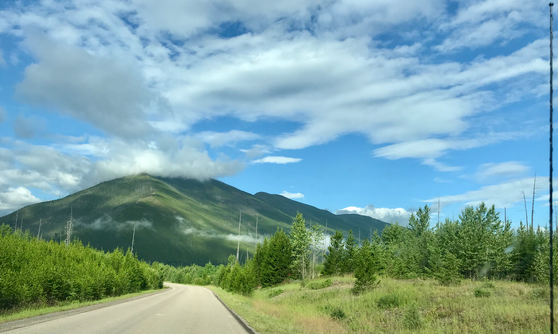 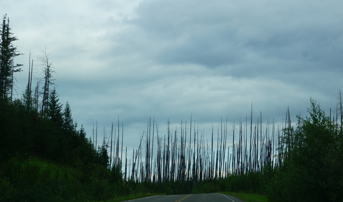 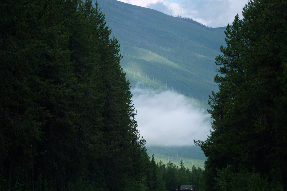 Leaving the park, Polebridge is a little community gathered around a general store and a few other little buildings. It is on a dead-end road, and thus there is no need to officially enter the park again on the return trip! 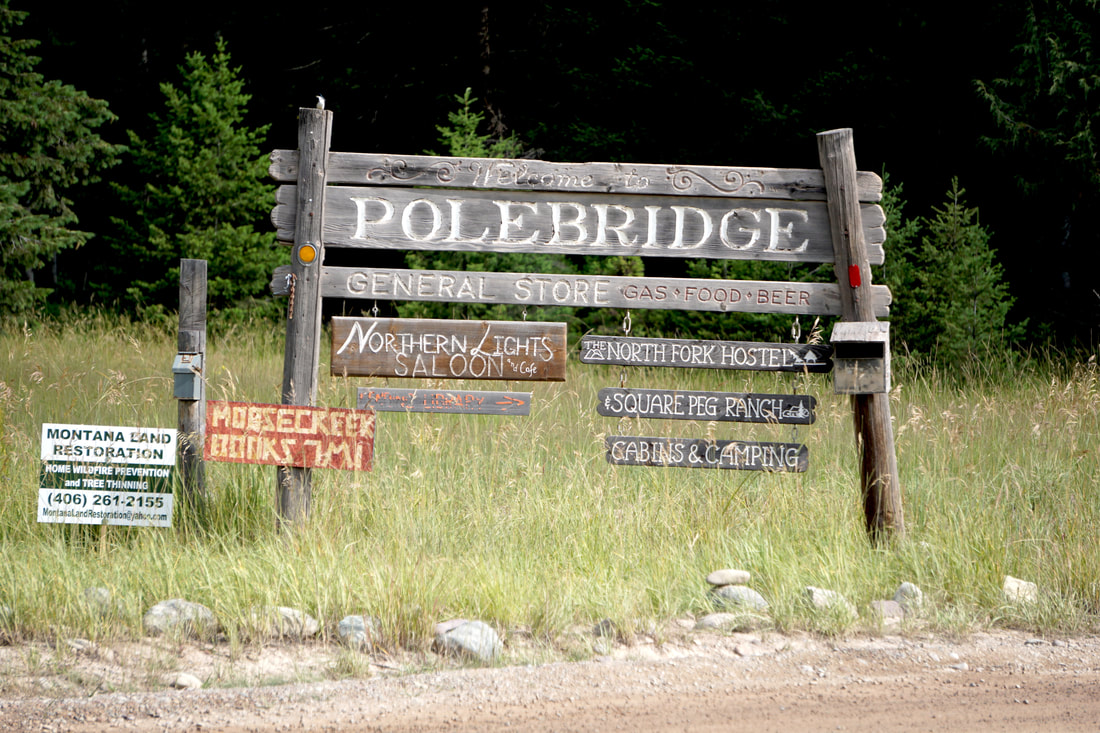 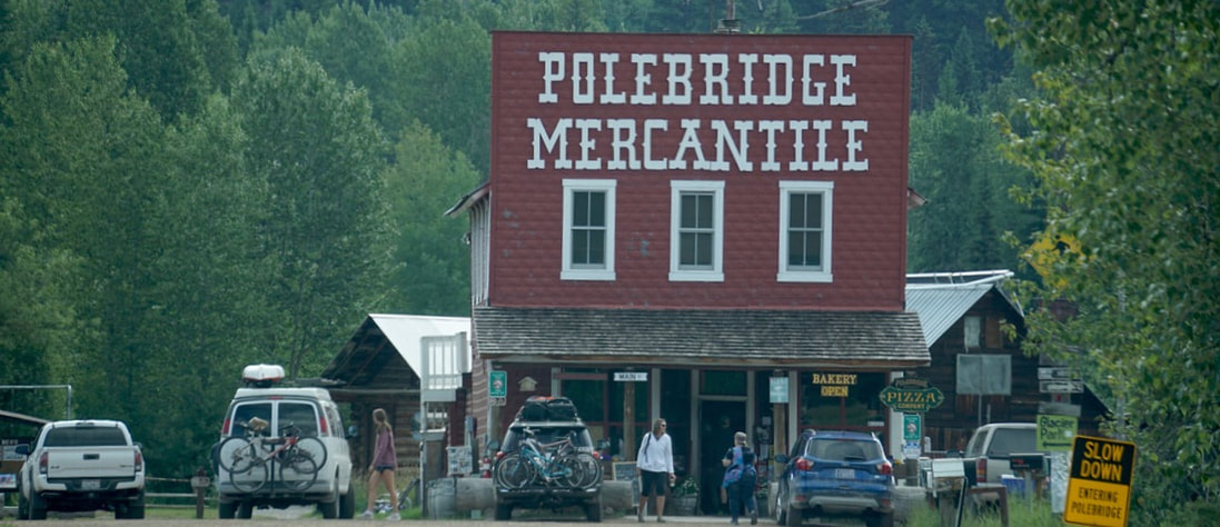     Polebridge Mercantile was packed with people and busy, busy, busy. Aside from the nice array of souvenirs there is a kitchen in the back with an active bakery shoving out all kinds of fresh baked rolls – many of them filled with huckleberry filling. Their biggest seller is the Bear Claw, that looks just like . . . a Bear Claw. We got two! They also do sandwiches – hot and cold.    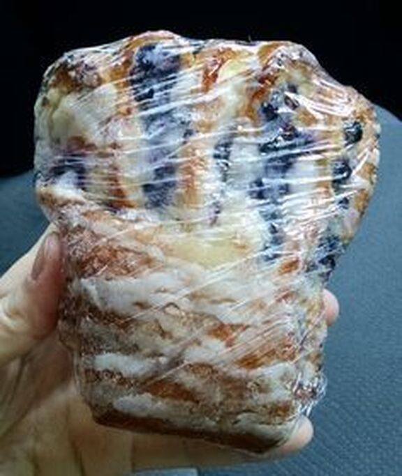 Past Polebridge we took the road back to Bowman Lake – six miles of bone-jarring, teeth cracking, breath-catching, titty-bouncing, narrow, dirt, washboard road. Top speed 13 mph! It was so bad I figured nobody would be back at the lake or the campground! WRONG! We felt like a member of some special survivor road club! I tried my best to get pictures, but they don’t show the wicked nature of the road, and I was afraid I would knock myself silly with the camera! 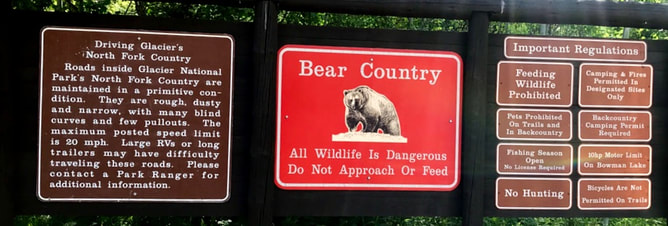 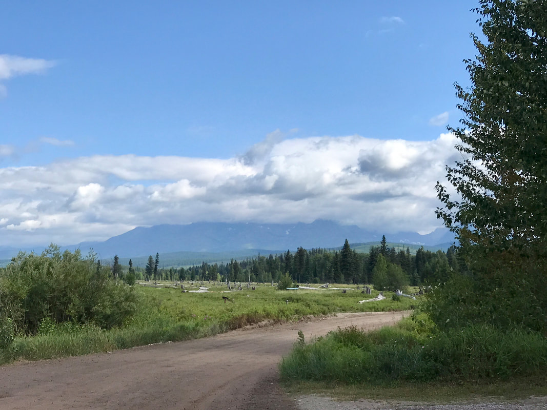 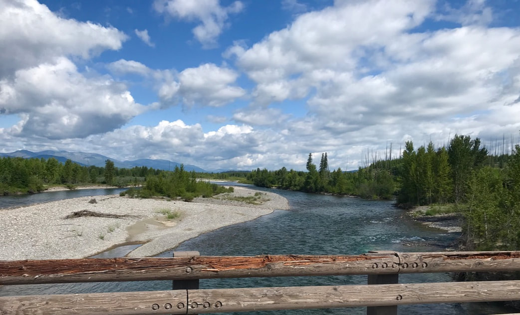 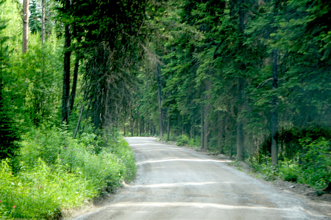 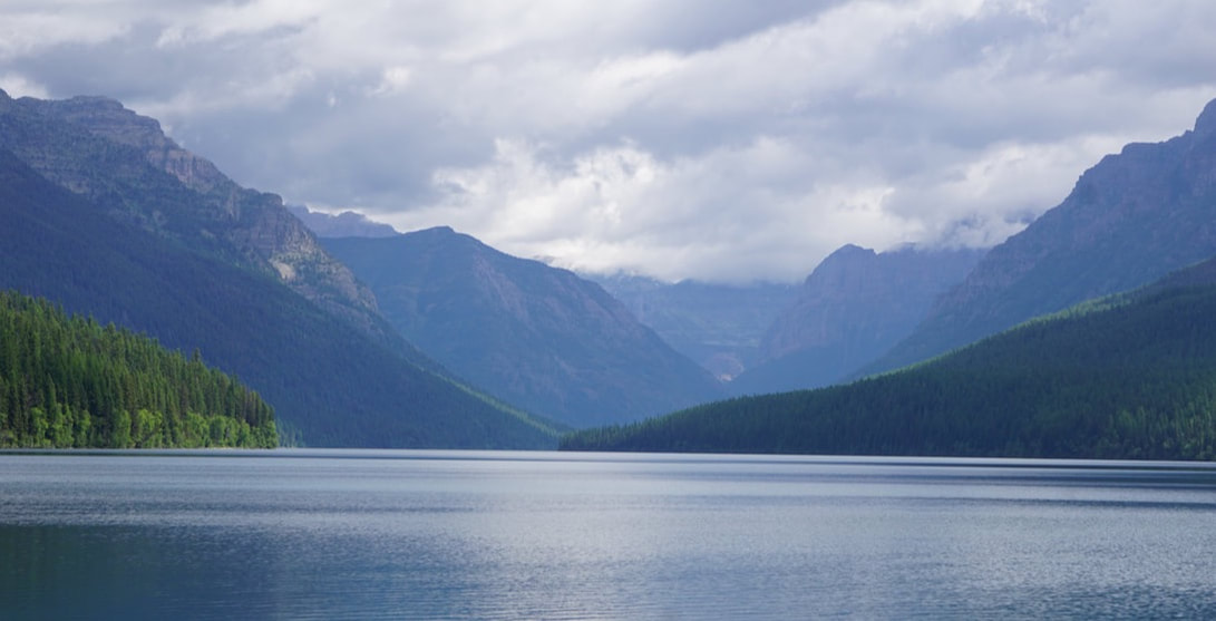 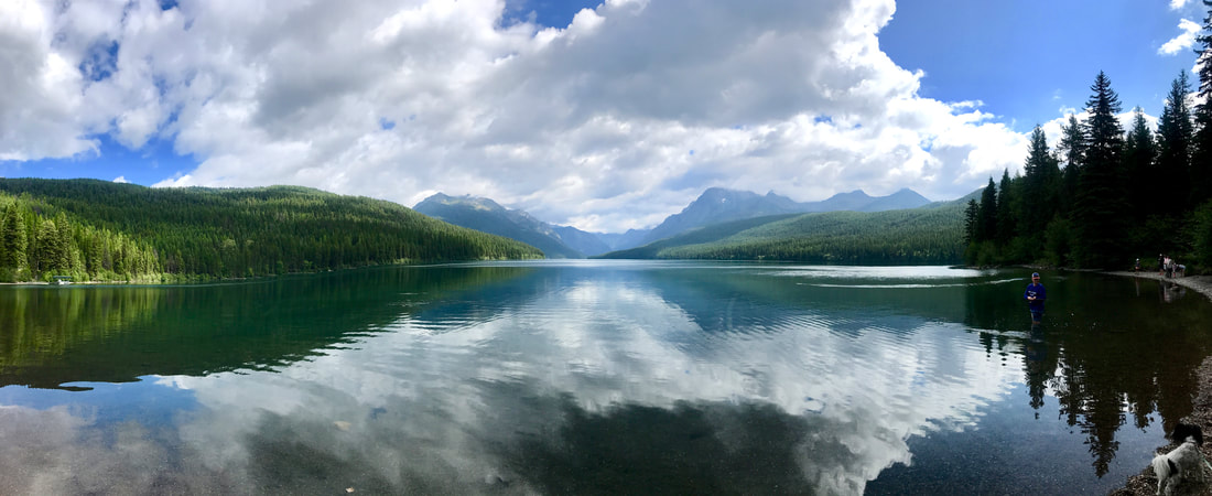 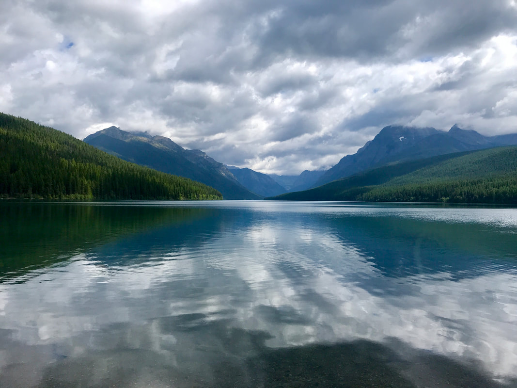 Then we had to do that road all over again; it seemed faster this time!
Around dinner-time it began sprinkling . . . just lightly, but enough to coax us into town to eat! When we returned we packed up, ready for an early launch in the morning. Monday, July 15 We didn’t venture far from our little corner of Glacier today. We slept a bit late and then headed for the little town of West Glacier outside of the park. Our purpose here was to snag some cell-phone service so I could use my hot spot to catch up on the blog. If I wait too long . . . I can’t remember what we’ve done! I was able to spend an hour to get most of yesterday hacked out – but I didn’t get it published. We saw an outdoor Glacier junk store that needed a walk-through (One moose antler cost $1,100)! 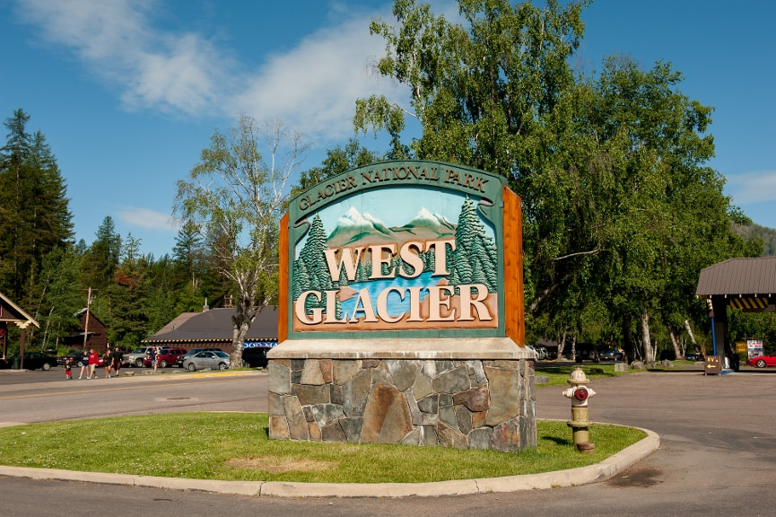 Back in the park, in the little settlement of Apgar we found a beautiful woolens-good store with a lady proprietor that talked and talked . . . and talked. The store used to be the schoolhouse for the Glacier area (1915-1958) and she told how many former students have come back to visit. On the back wall were some beautiful pictures of school children and their teacher in all sorts of activity – many had visited the store and identified their picture. 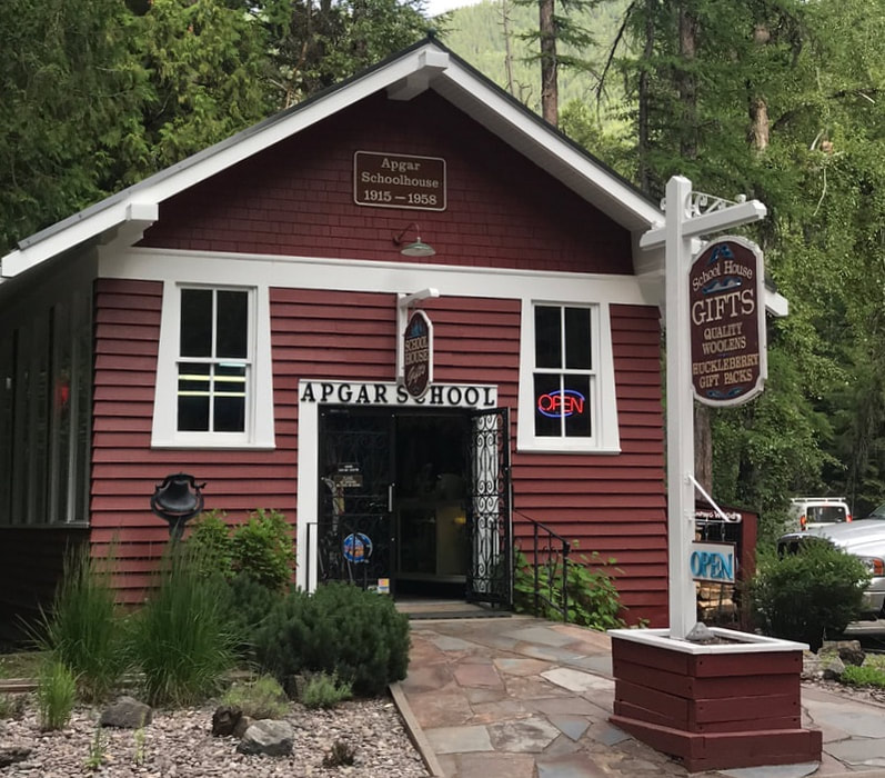 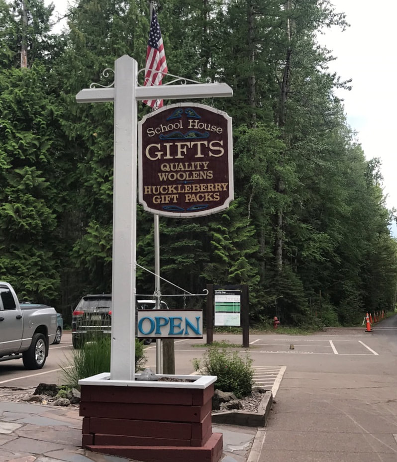 We hung around the campsite awhile in the afternoon – I am starting a new basket – and then took a walk down by McDonald Lake. Tom wore water shoes on the walk (I have NEVER known him to leave the campsite in anything less than full boots) and he was determined to wade in the cold, clear water!  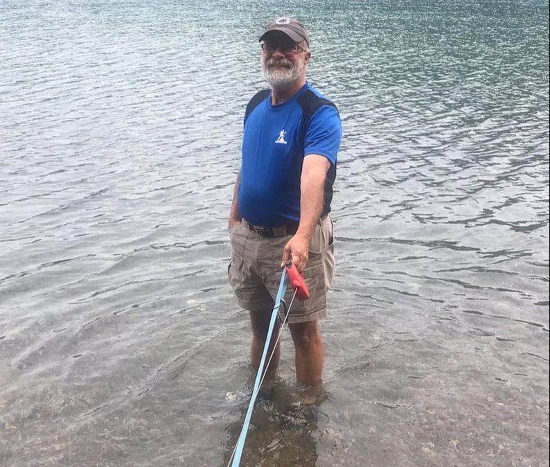 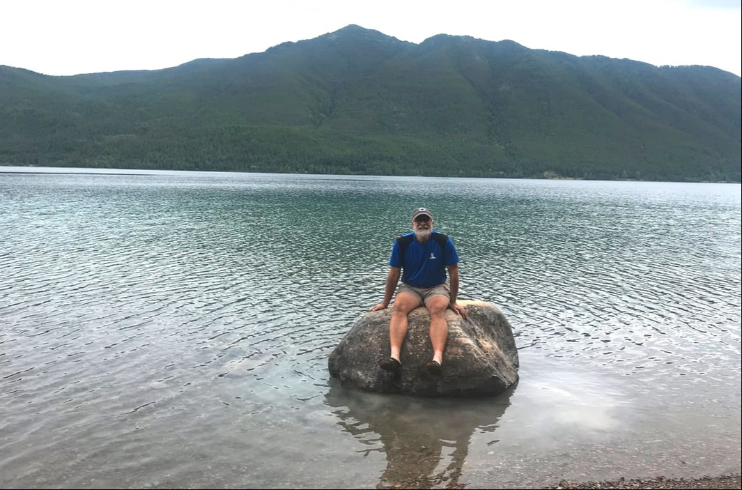 Pork Chops cooked on our Biolite Stove that is simply fed with wood and twigs. Tom has been using a bag of hickory chips, and everything grilled has had the most wonderful flavor! The little stove creates heat, which converts to energy to charge a battery and fan system, which gently blows the flame and keeps it roaring! You can even plug your phone into the USB port and charge your phone while cooking! It has been our main-stay for outdoor cooking on this trip. 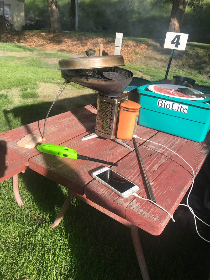  Then we headed back into Apgar (4 miles away) for Huckleberry Ice Cream; first there were some nice shops to look through. We also drove through the Apgar campground and found it not so deeply wooded, and sites that could easily accommodate large rigs. 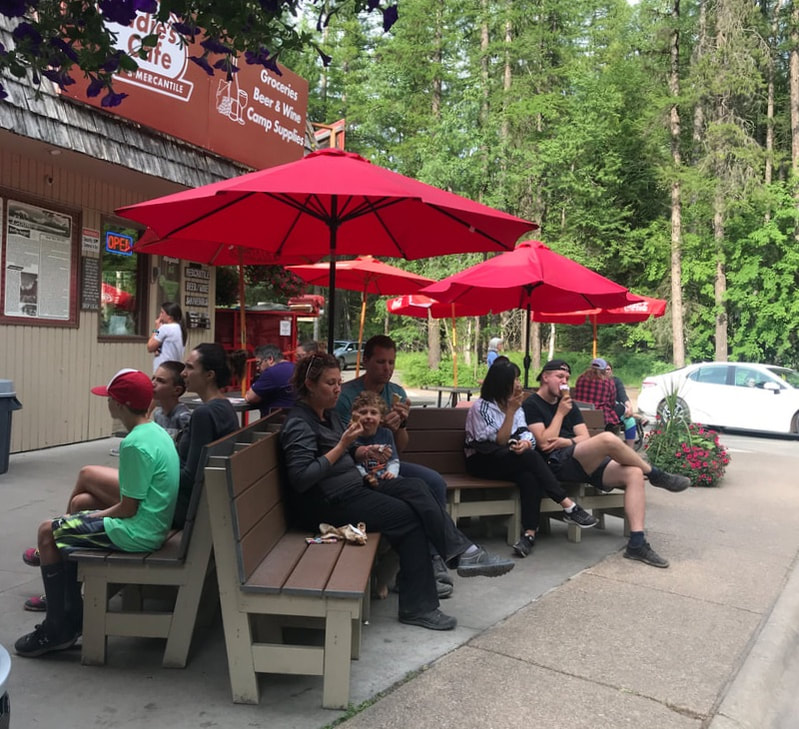 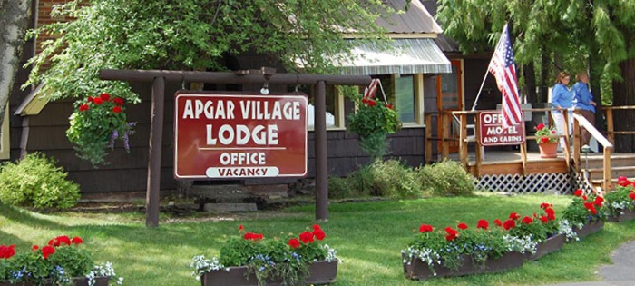 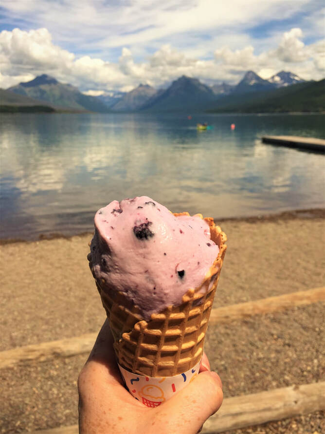 All and all, a lovely, slow day in Glacier.
Sunday, July 14 Not many people get to wake up on their birthday at Glacier National Park! To welcome me on this 67th year of my birth was a glorious sunny day . . . and a trip on the famous “Going-to-the-Sun Road.” (I declined when Tom asked me if I wanted to drive the road this time!) 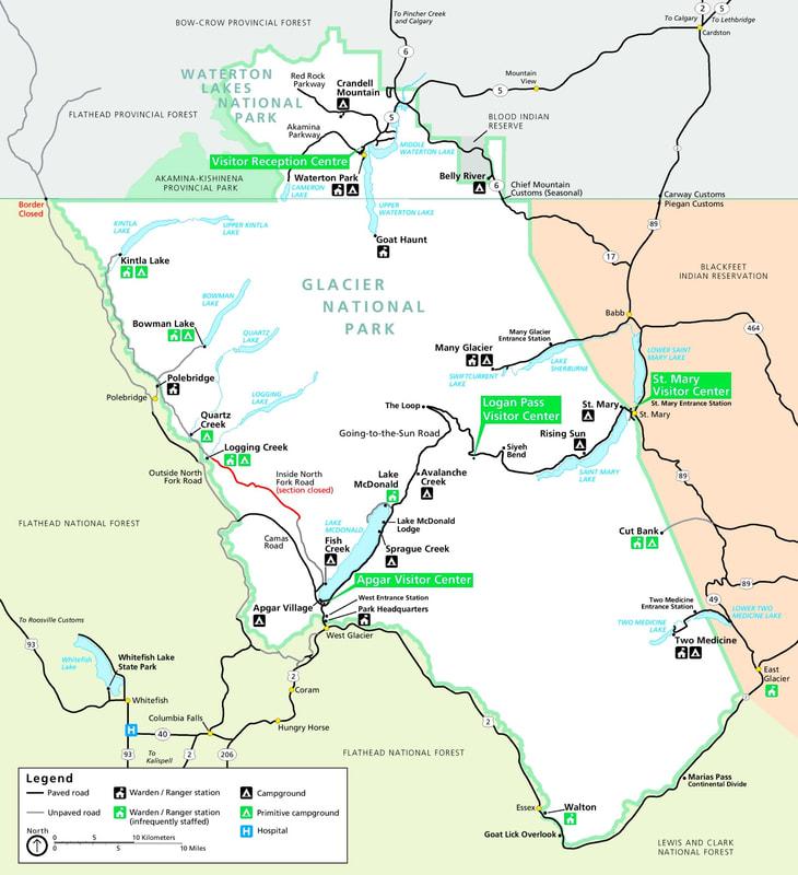  Going-to-the-Sun Road is one of the world’s most spectacular highways. It bisects the heart of Glacier and follows the shores of Lake McDonald on the east, and St. Mary Lake on the west. There are lots of scenic turnouts with jaw-dropping views, and at times the road itself is rather stomach-churning. Vehicles over 21’ long/8’ wide are not allowed. In addition, the rock overhangs interfere with anything over 10’ high! It starts out as a pretty normal, tame road in the mountains. 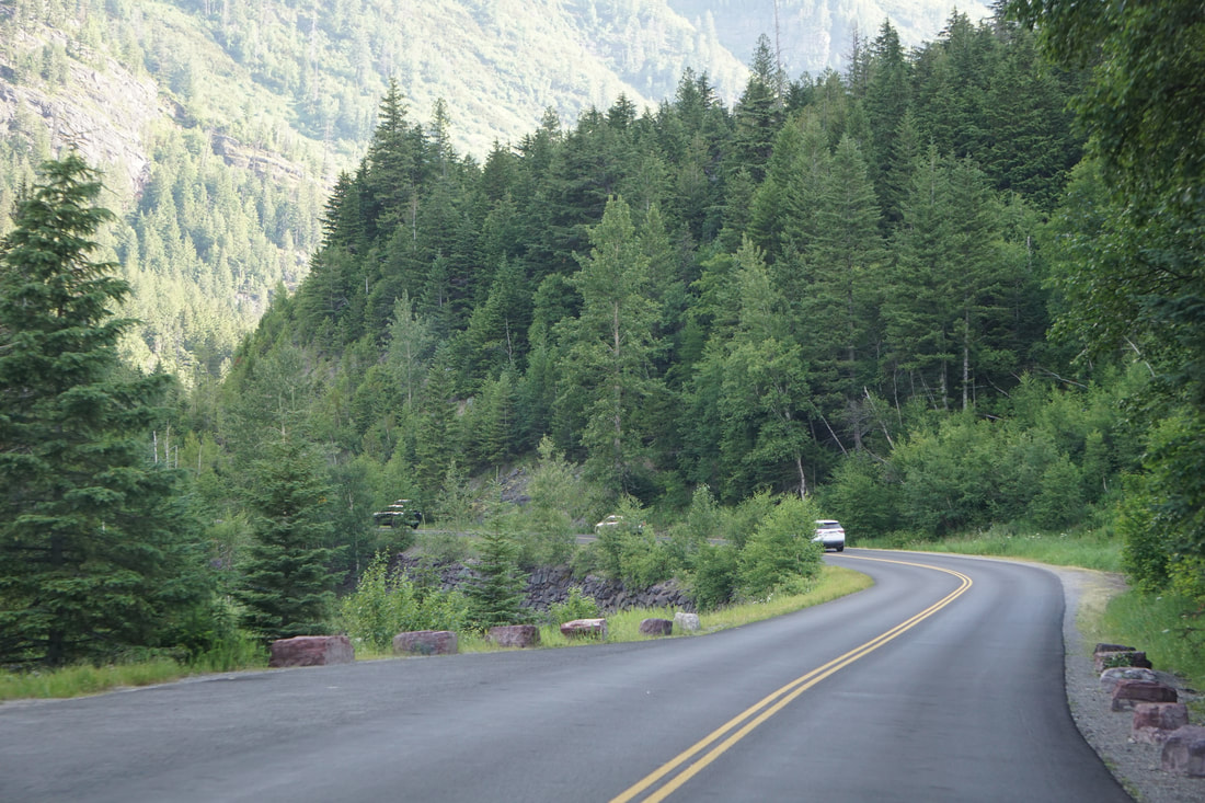 As it progresses uphill, around tight curves, and past deep valley views and jagged mountain vistas, it earns its reputation as a white-knuckle roadway! 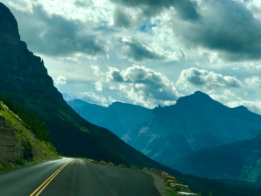 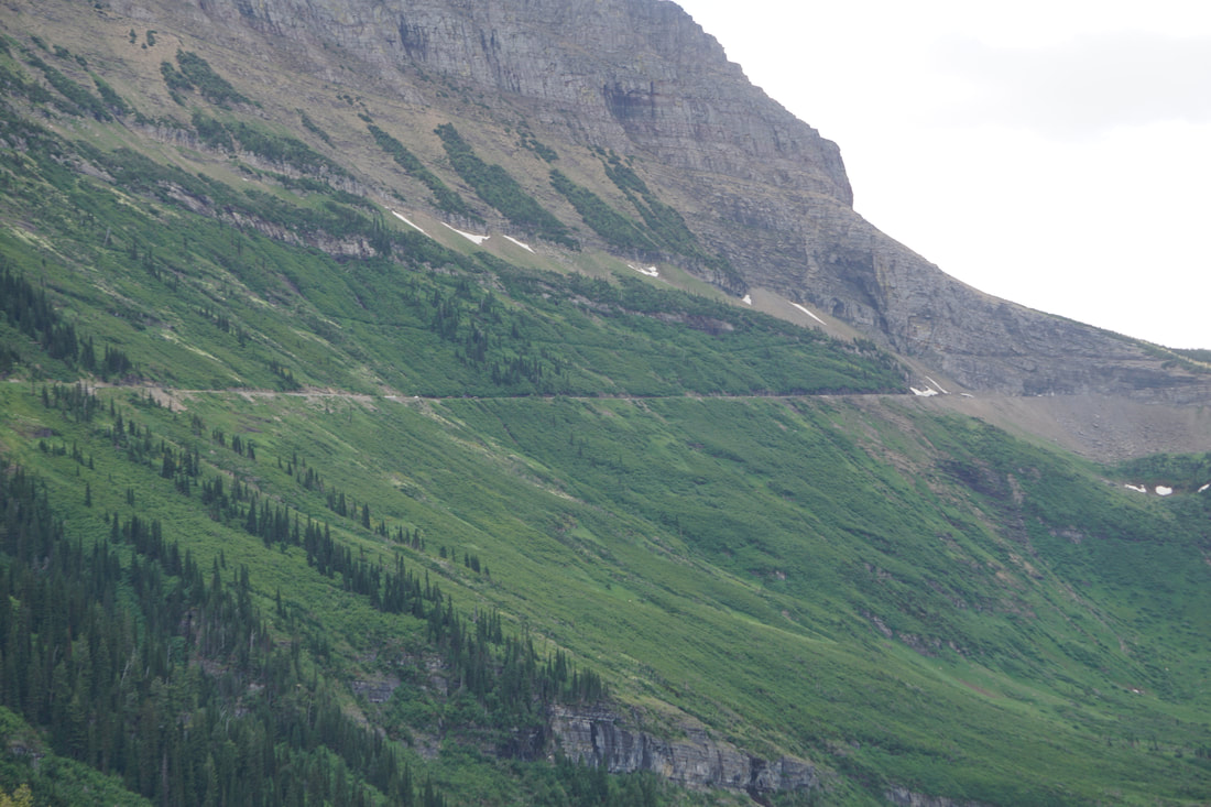  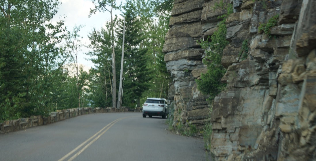 The road was congested with cars, bicyclists, and sometimes even foot traffic. Many of the overlook pull-offs were crowded, and the famed Logan Pass Visitor Center parking lot was full . . . with a waiting list! We drove right on past. Here are some pictures of our eastbound trip. Tom did a brave, steady driving job. I developed a crick in my neck from sharply tilting my head away from the cliff side. Maybe I’ll stretch it out on our westbound trip! 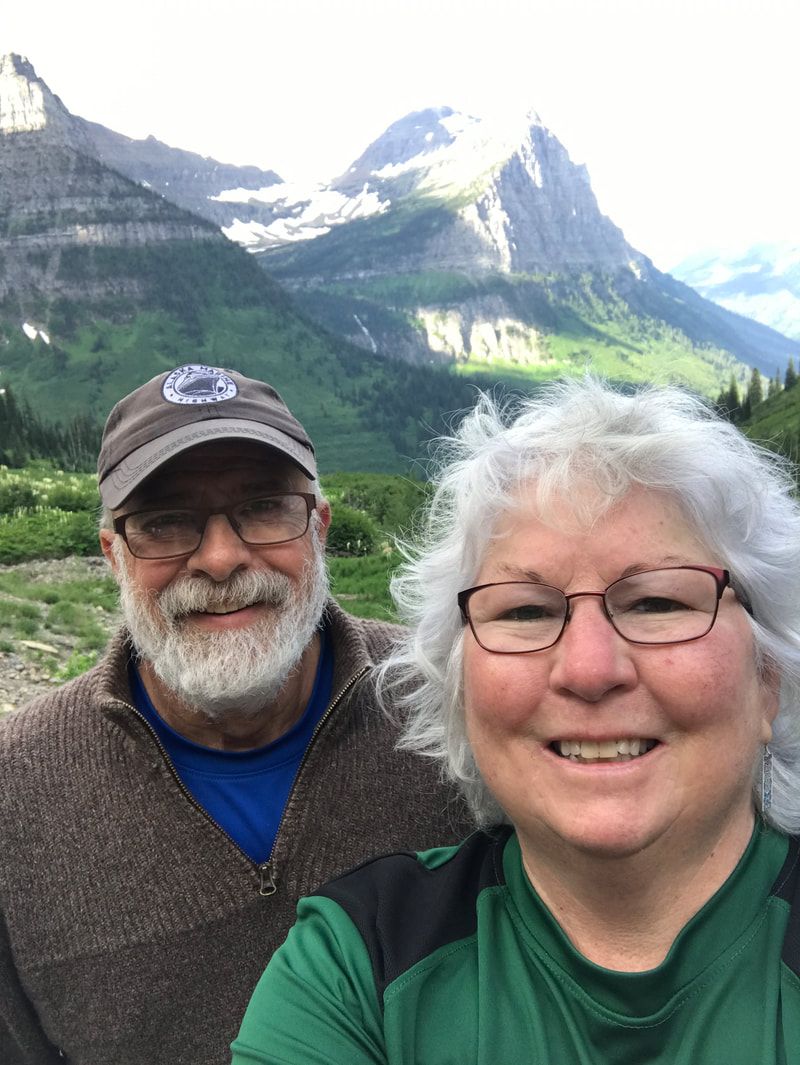 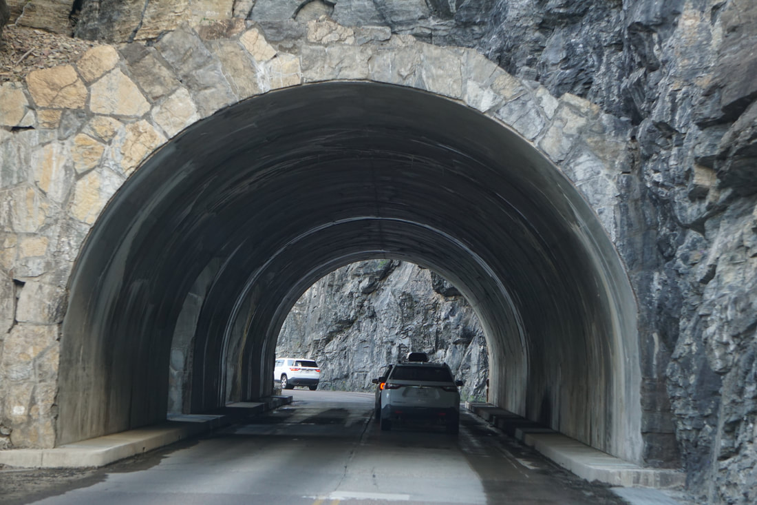 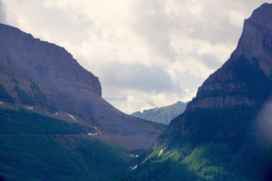 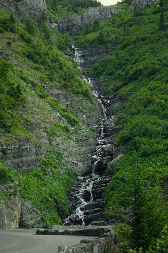 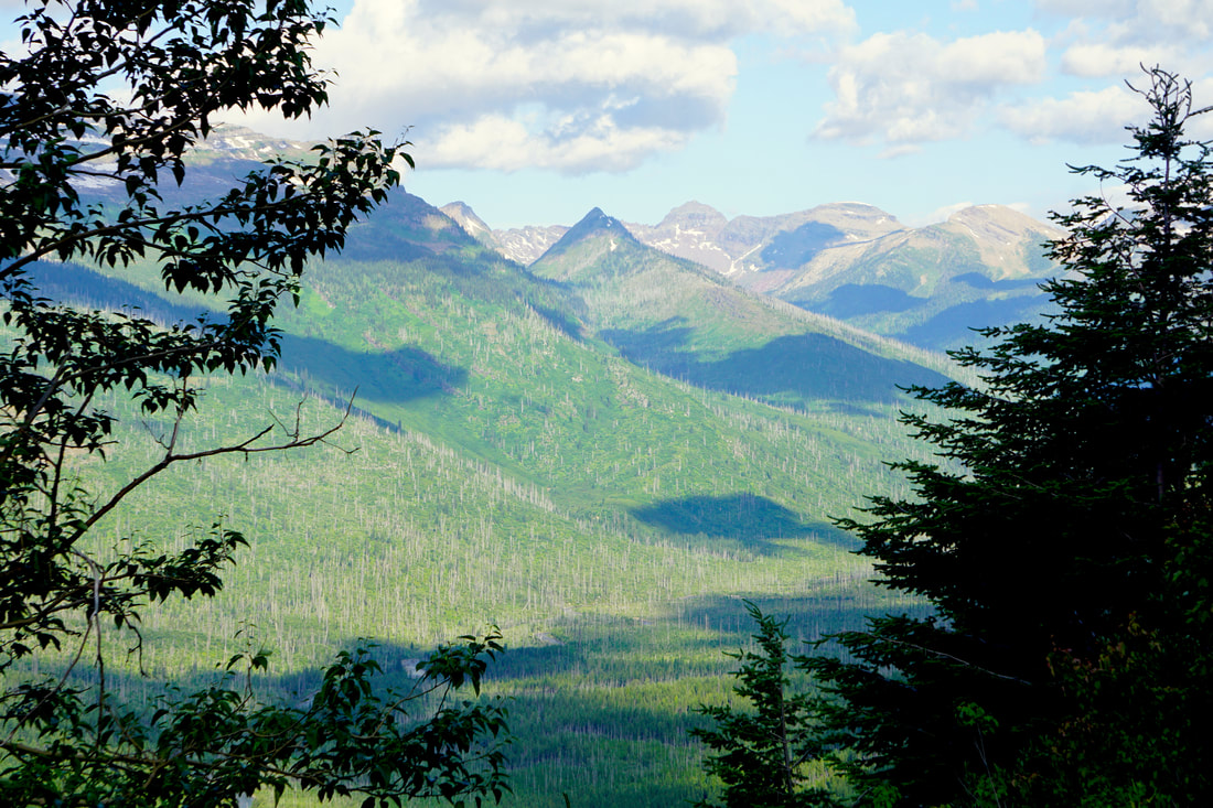 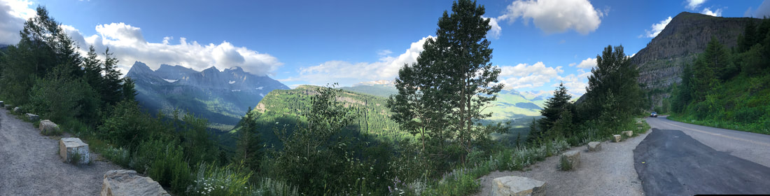 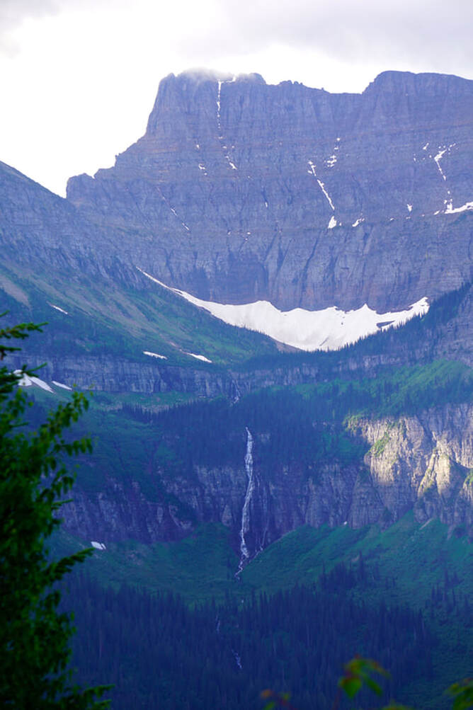 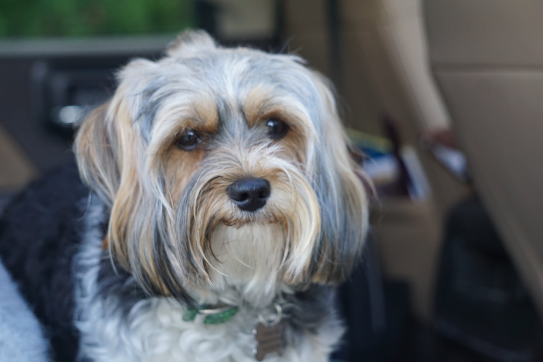 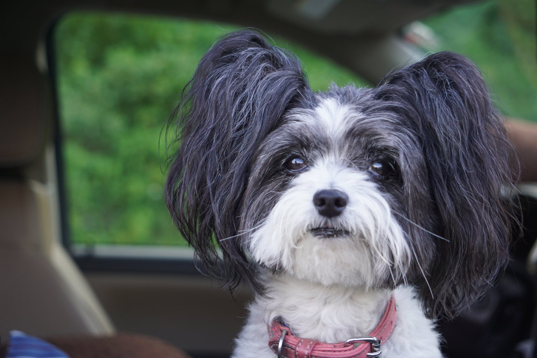 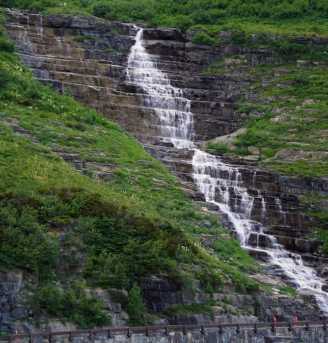 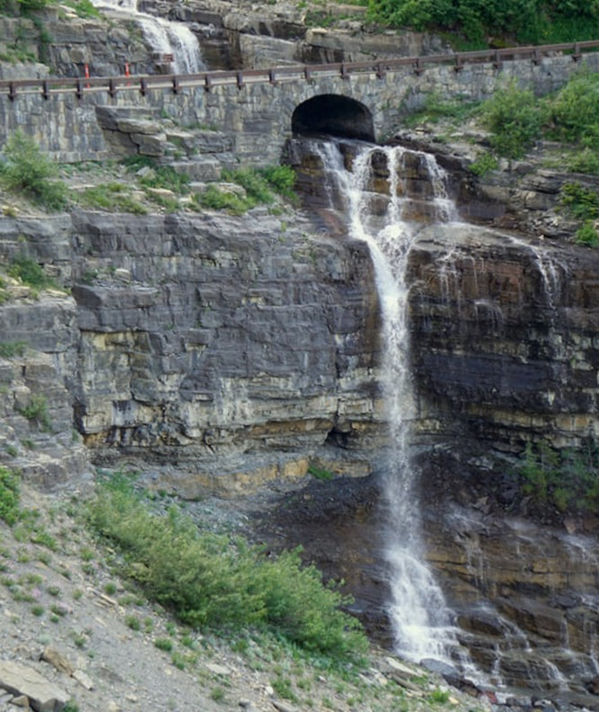 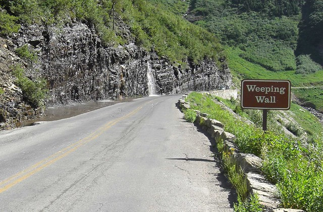   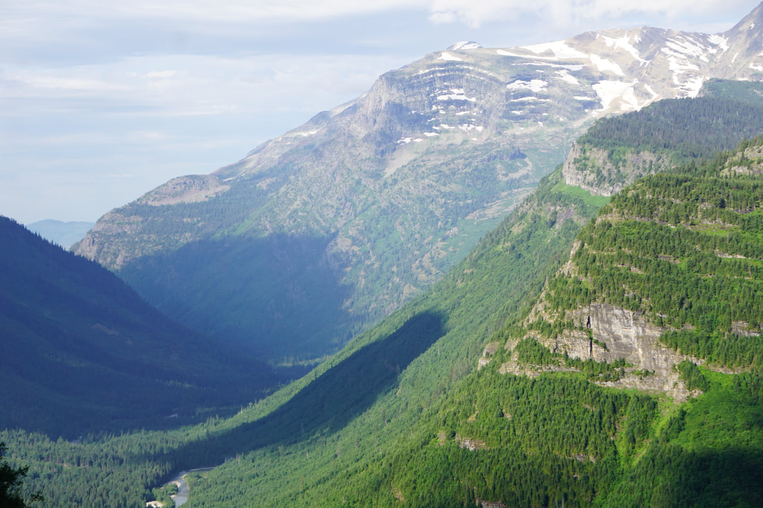 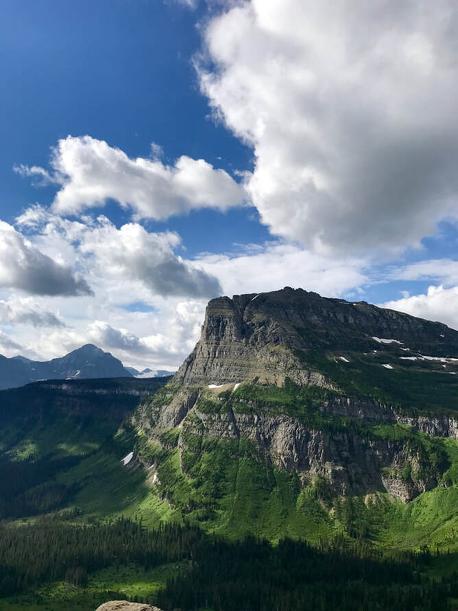 We went out of the park at St. Mary, drove 8 miles, and went back in at the Many Glacier entrance and drove 12 miles back to see the glacier. The big surprise was the historic hotel, situated along Lake Sherburne. Only pictures of this location can even begin to explain why it is my new-favorite! 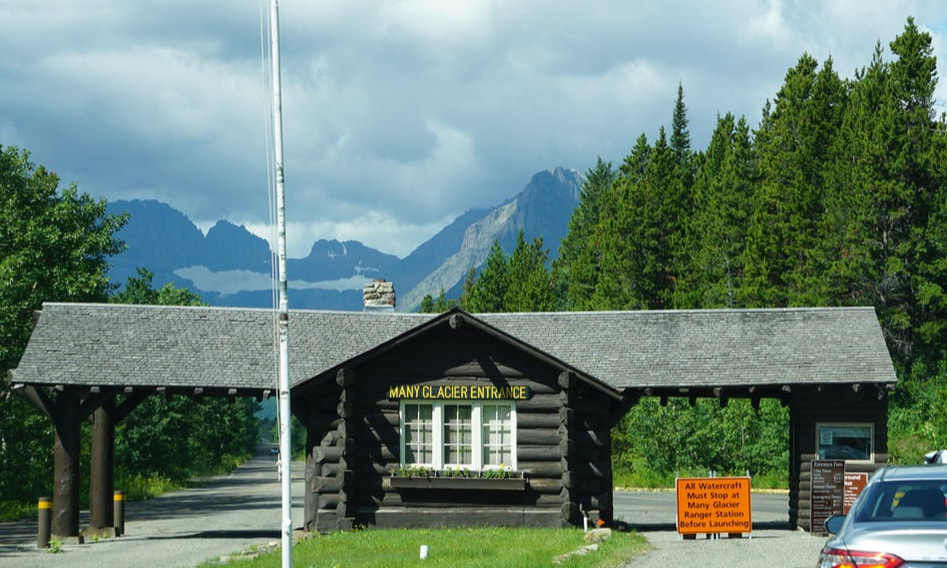 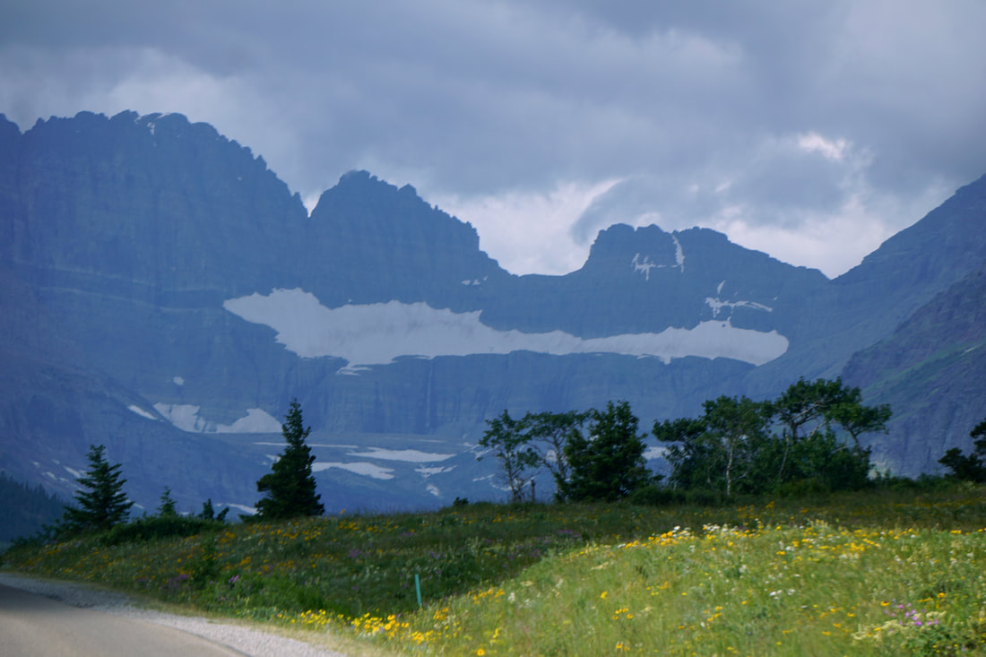 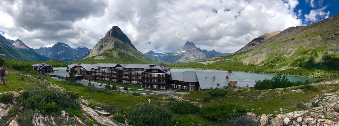 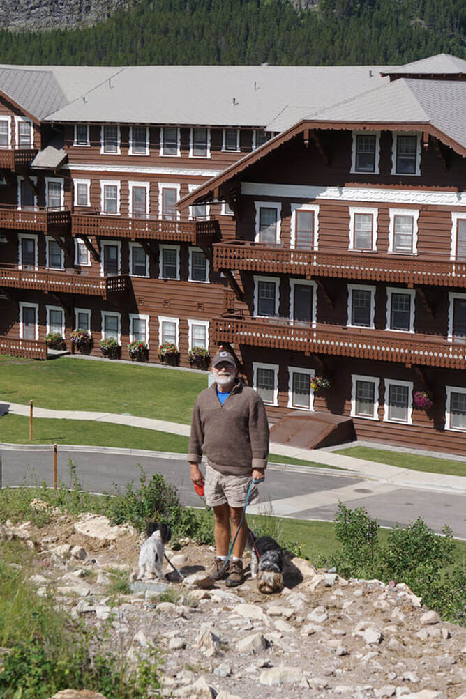 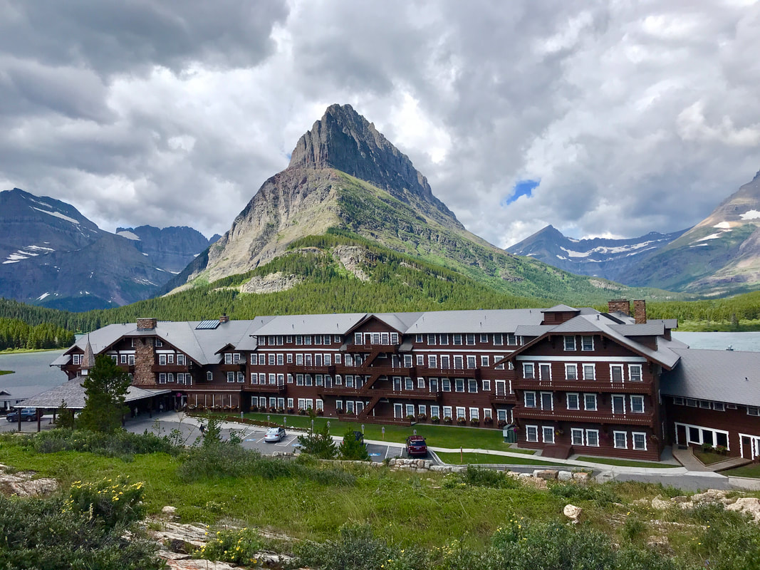 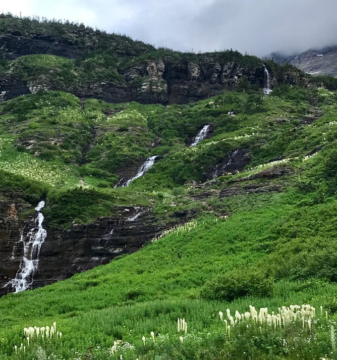 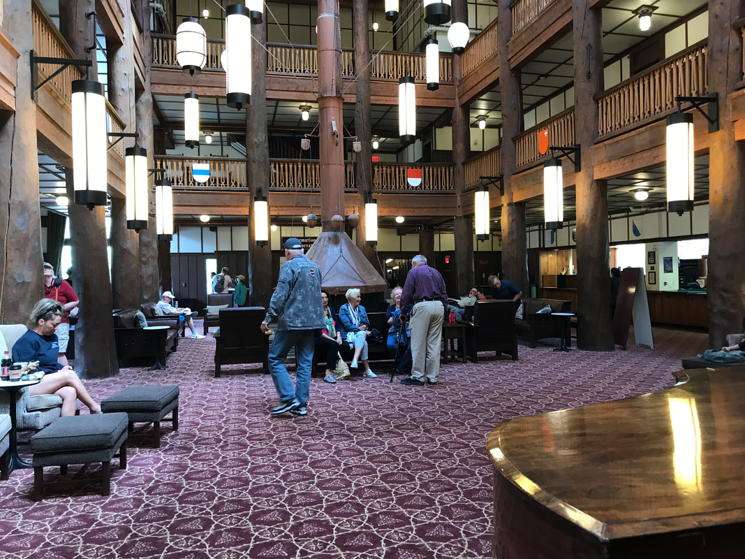 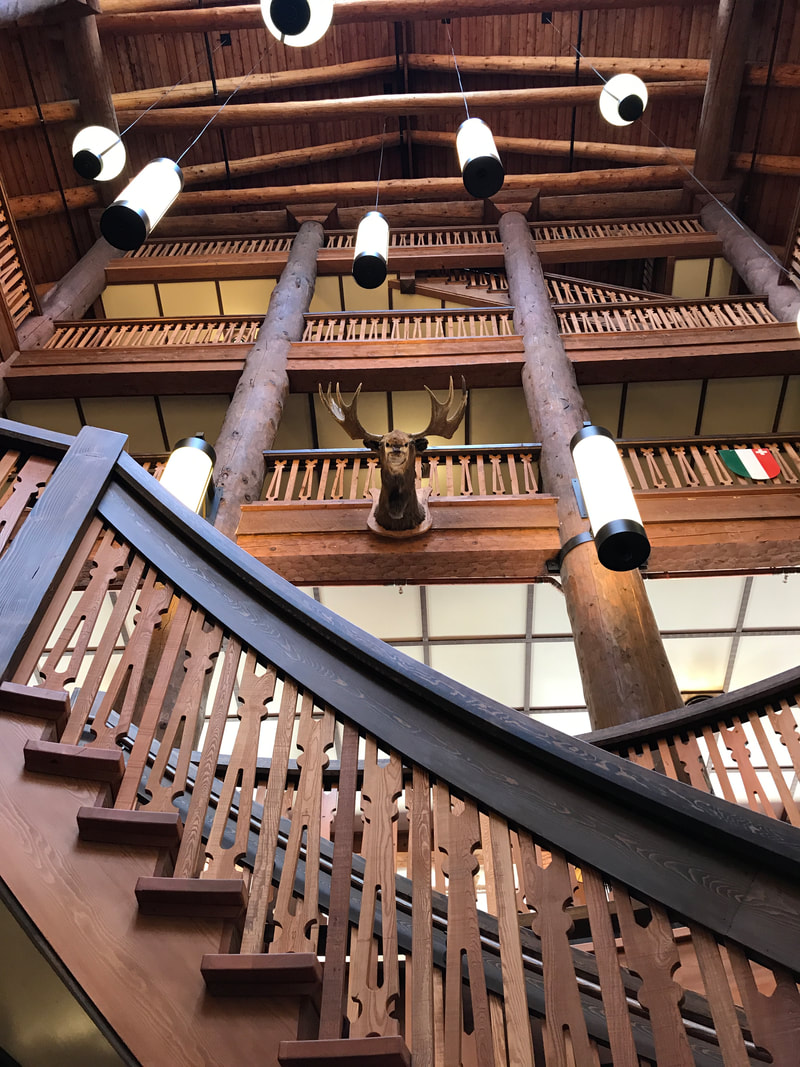  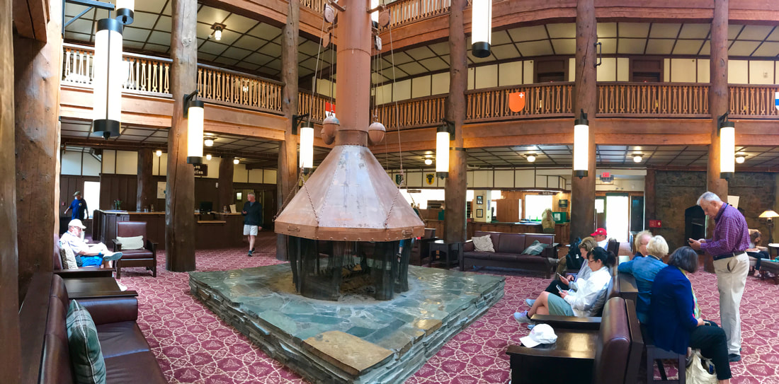  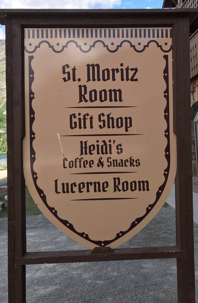 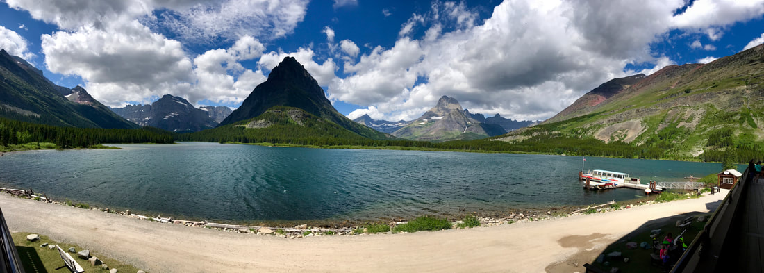 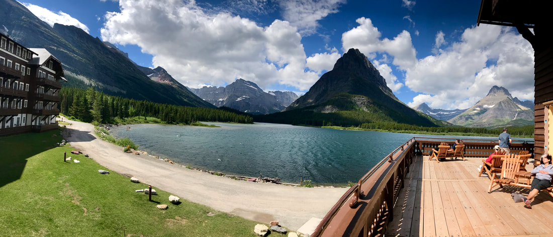 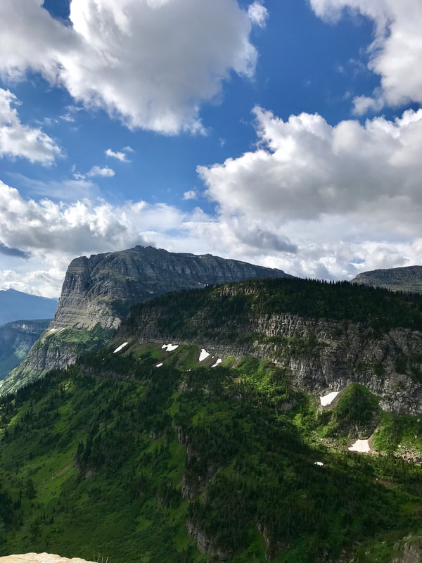 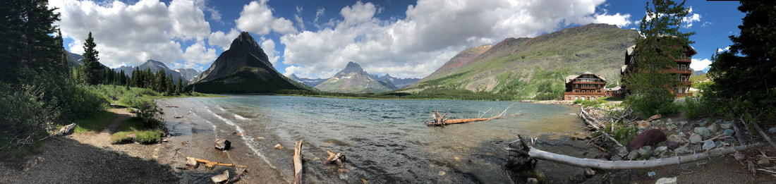 We had been warned that the traffic has hit the summer high mark on the Going-to-the-Sun road and at times cars would be stopped; then one car out and one car in. We had not encountered that on or west-to-east trip, and we were hoping it would not be the case on our return trip. We breezed right on through, this time on the inside lane, but with a good view of the drop-offs! We were back at the campsite by 3:00 for a rest and a shower. At 4:30 we left for McDonald Lodge, just 8 miles down the road. We remembered our meal there 4 years ago, and were ready for a repeat – a birthday dinner for me! Tom had the Pork Shank, and I had the Rockfish, both with Brussels Sprouts, potatoes and . . . drinks.  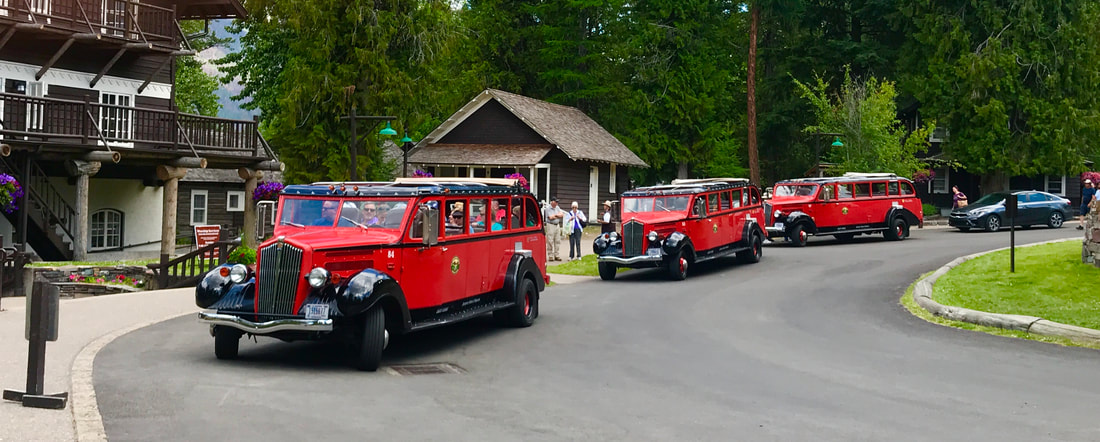 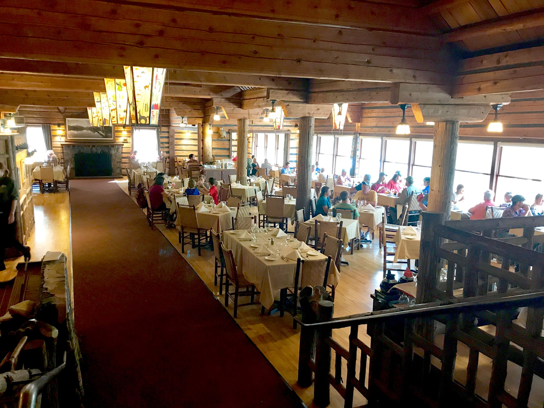 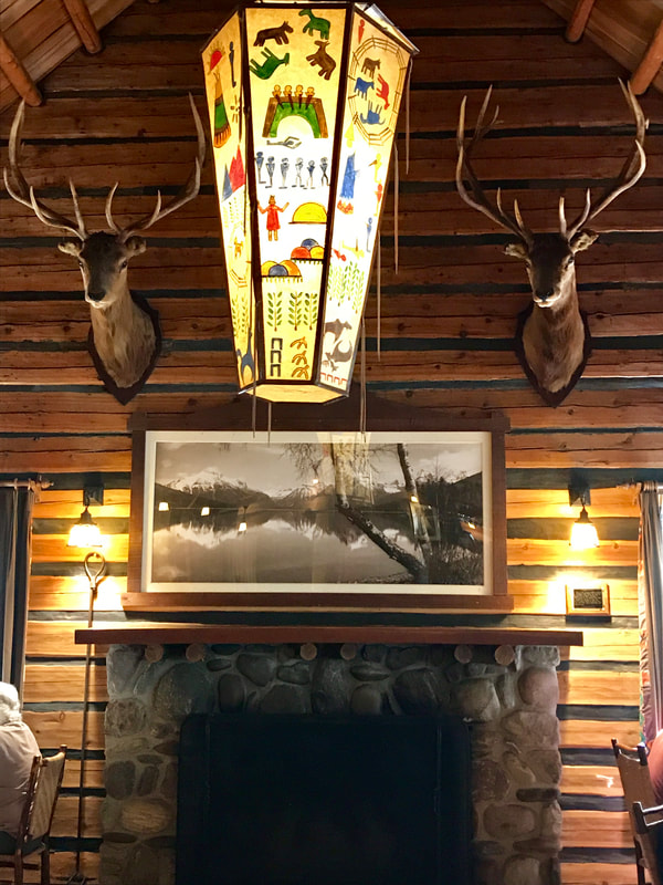 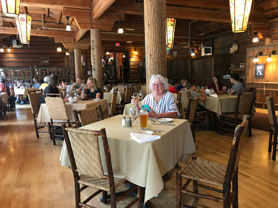 Saturday, July 13 What could make me bounce out of bed at 6:00 a.m. this morning? We’re heading for Glacier National Park . . . one of our favorites! All we had to do was follow US Route 2 for a little over 300 miles – out of Washington, through the panhandle of Idaho, and into Montana. In the process we crossed a time zone and on the way east, it takes an hour from us. 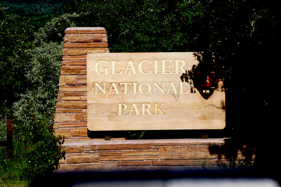 We found our campsite – D151. It was a pull-through. Simple. Except that it wasn’t! We love the pro-pride hitch, but the one limitation is that the truck needs to be in a fairly straight line with the trailer when hitching or unhitching. This pull-through required Tom to pull in and keep curving around until the trailer was off the main road. He maneuvered as much as possible, putting the trailer right up next to the hill on one side . . . and hemmed in by a cluster of three trees on the other. It took the height of three boards to level it out side-to-side. All would have been well, except that the alignment wasn’t quite straight enough. He unhitched the trailer from the truck and pulled forward to pull the stinger out. Disaster struck as the stinger got hung up and pulled the trailer with it – off the level boards and off the tongue blocks. Tom spent time working his mind around what had happened. He couldn’t raise the coupler on the trailer high enough to slide the stinger on the track back in. He had to approach it differently by retracting the tongue all the way up and putting three thick boards under it. But, before he could do that he had to get leveling boards under the hitch so there would be room to put to lift the tongue jack post high enough to get boards under it. Then he had enough height to raise the coupler. But, the hitch and coupler were still at an odd angle to be able to slide that singer straight back in. It took about 6 tries, and he had to push and pull the coupler while I held it in place to change the angle while he backed in. Got it! Except now the angle of the whole rig was changed and as he pulled forward the back window and awning bracket snugged right up to those trees! Tom again spent a few quiet moments checking it out, and then removed the arm of the awning and swung it up and out of the way. This left the window and aluminum siding slightly touching the tree, but Tom managed to slide forward without scratching anything. Some of the window hardware-buttons that stick out from the glass had tree bark on them! The campground is full, so it was this site or nothing. We noticed that if we pulled the trailer in the wrong way through the pull-thru, there would be more room to straighten out. BINGO. So, were here at Glacier! Just a few pictures: the tree we lightly rubbed, the campground and our campsite!   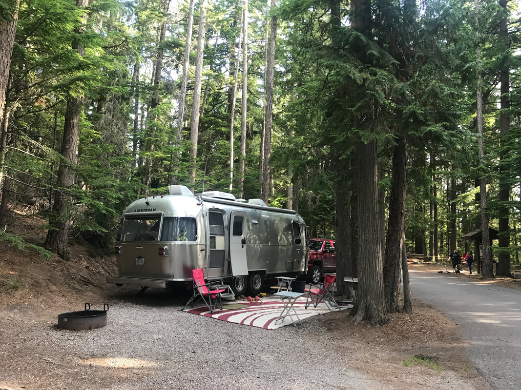 Friday, July 12 What a difference the other side of the mountain range makes! We slept with every window in the camper open – not because it was hot, but just because we enjoyed the dry air after weeks in high humidity/rain forest environment. We stepped out of the Silvermine in the morning to a sunny 65 degrees prompting Tom to fix eggs and sausage for breakfast. We only had 125 miles to travel today, but at the midway point we had to stop for the Grand Coulee Dam. When it was built, the Coulee dam was the largest concrete structure built in the WORLD! Still is today! The facts about the height, thickness, cubic feet of concrete and comparison to Egyptian pyramids (it dwarfs them!) go on and on. When the dam was finished in 1942 four cities sprang up around it: Grand Coulee, Coulee Dam, Electric City, and Elmer City. We stopped at several overlooks and the visitor center for pictures. 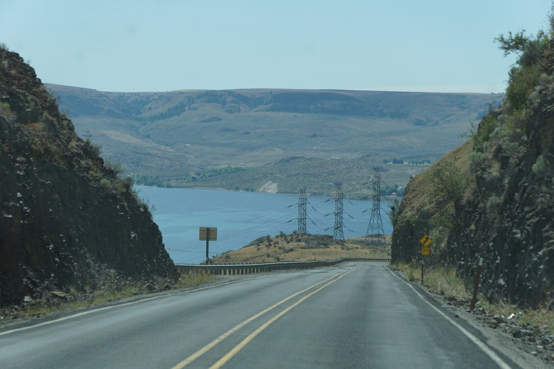 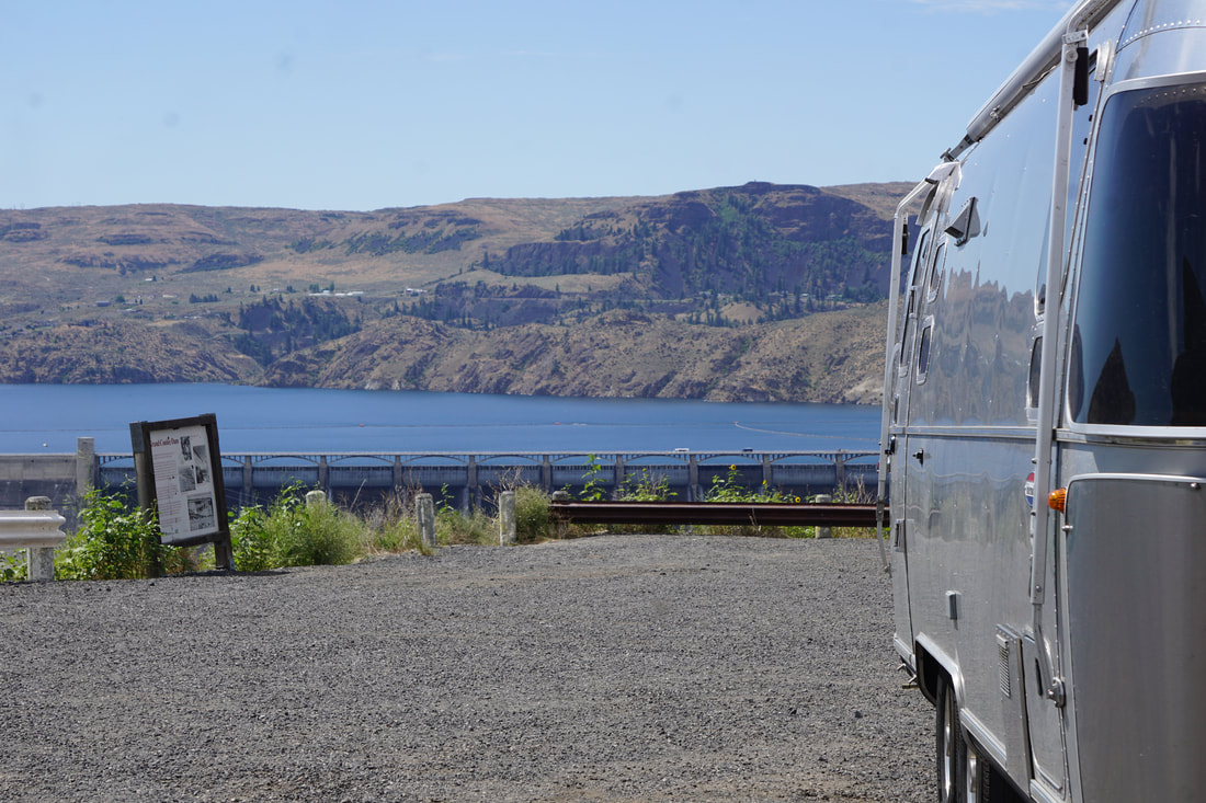 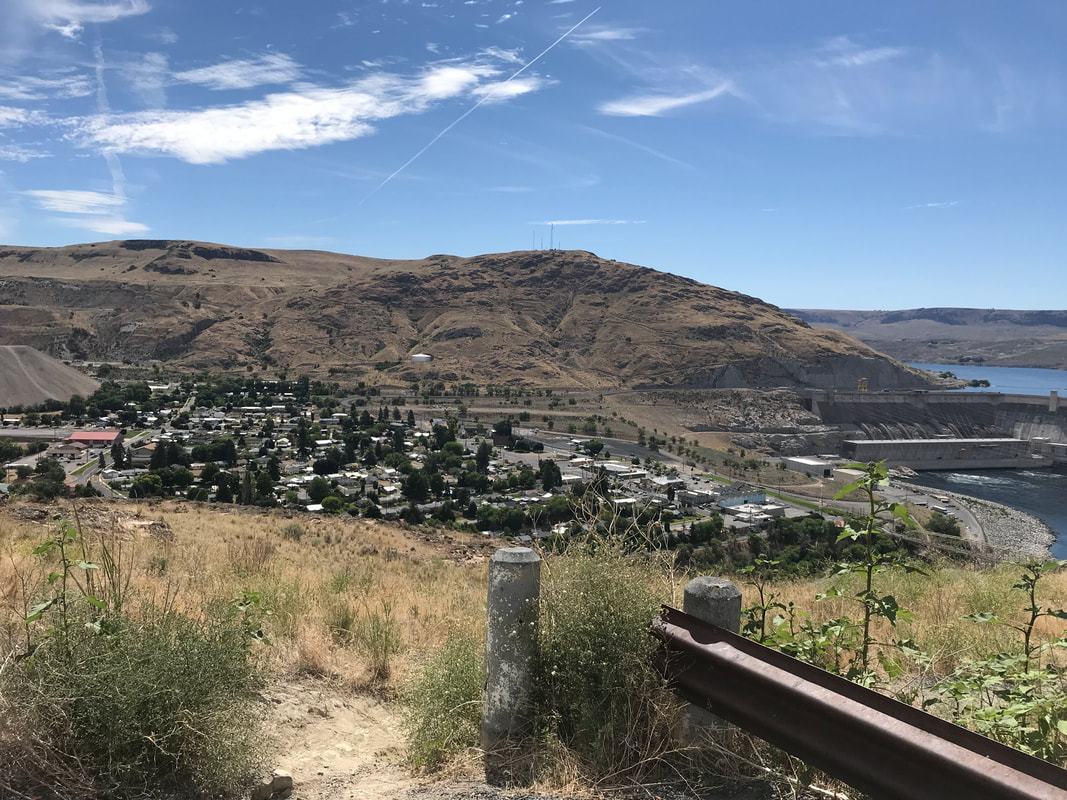 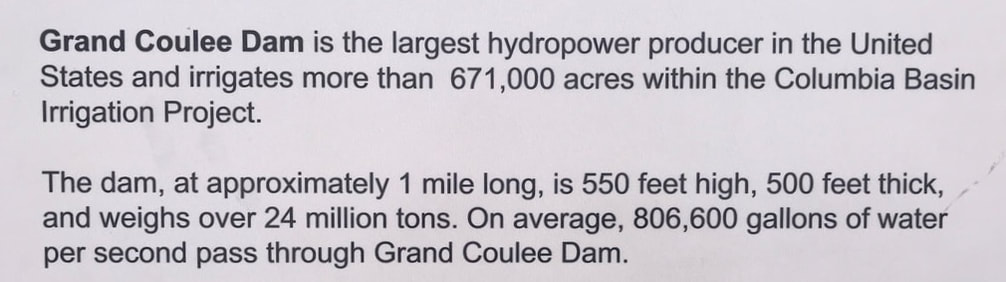  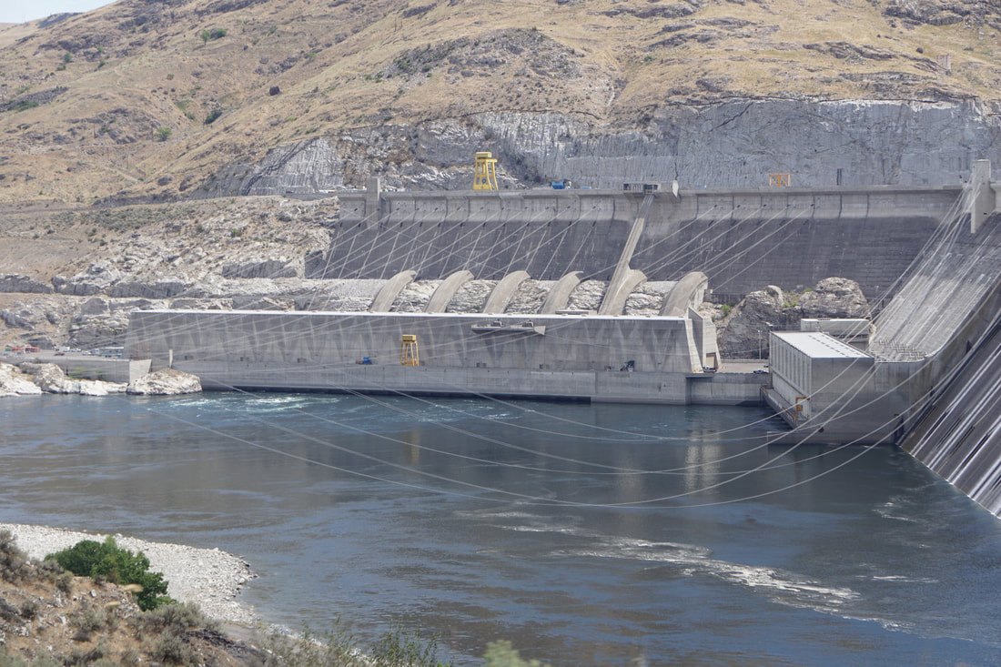 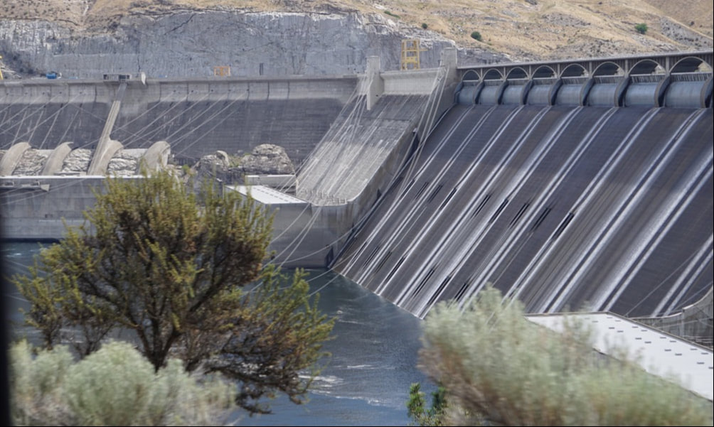 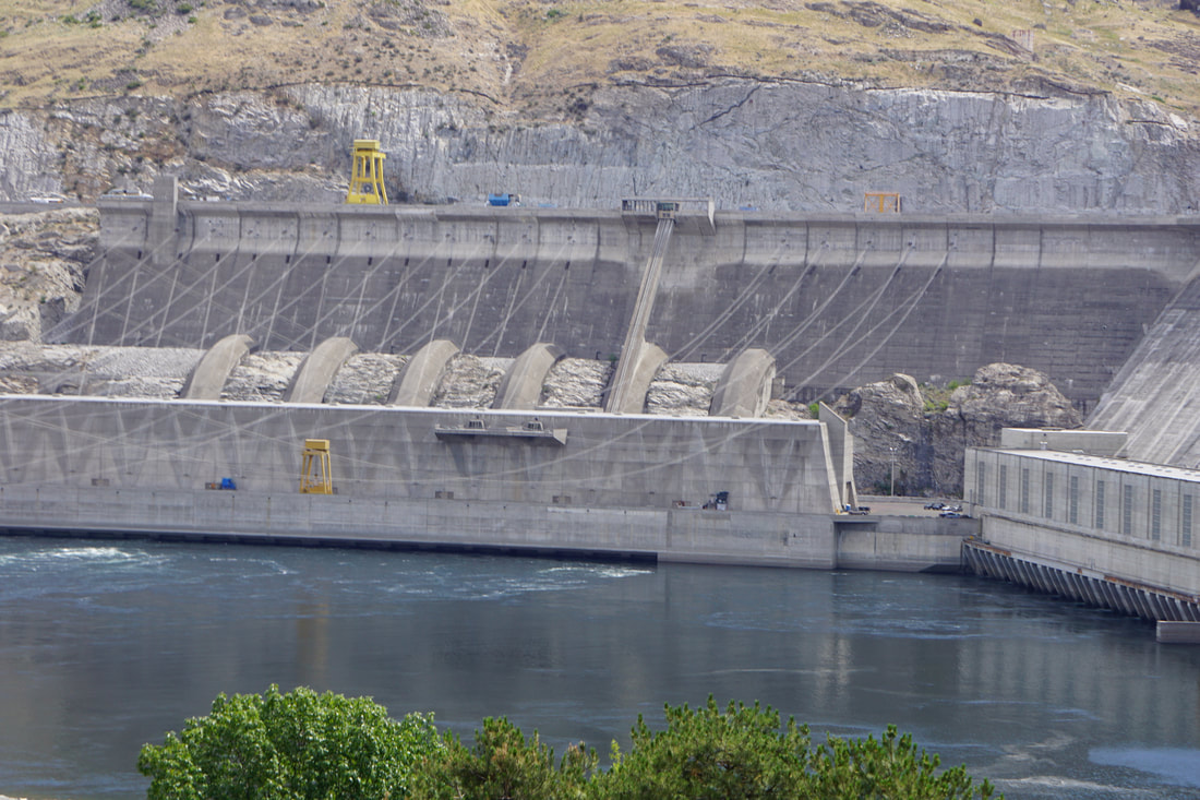 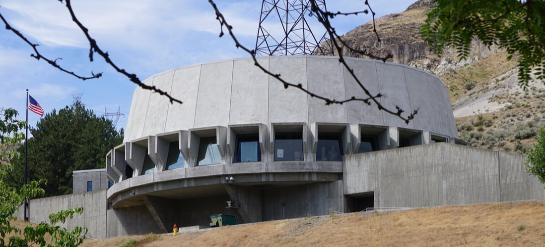 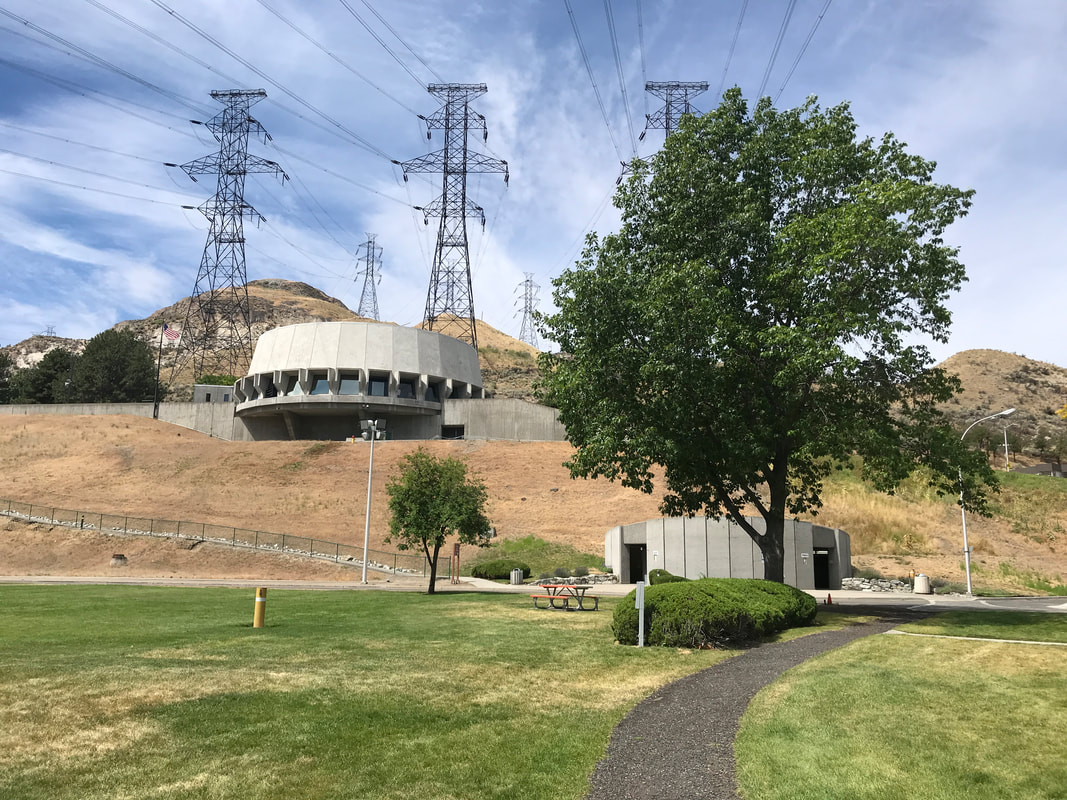 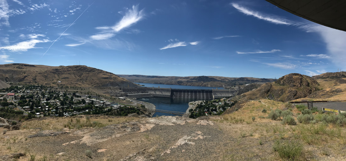 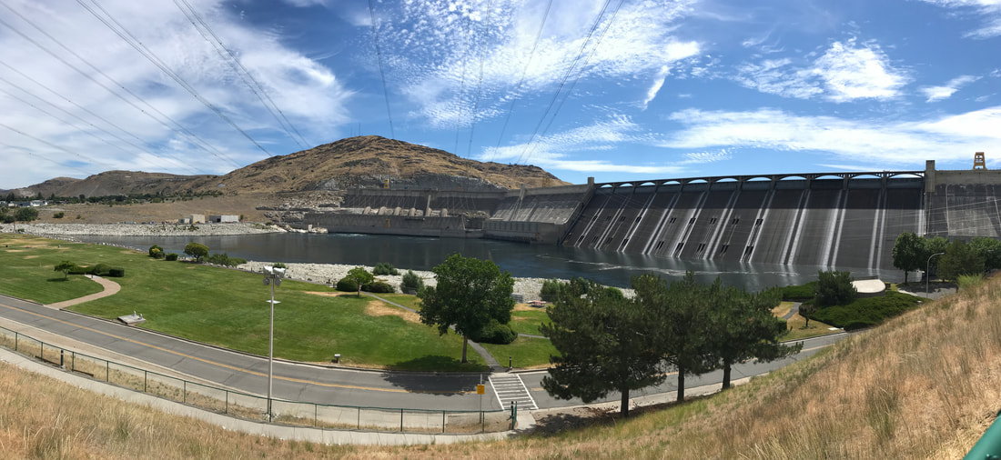 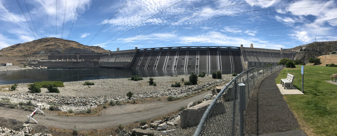 From there it was thirty-five miles to Riverside State Park/9-mile Recreation Area – it took us 2 hours! Everything combined (maps, ranger directions, GPS, Tom’s usual inborn sense of direction) to give us bad advice to end up at our campground. That’s all I’m going to say about that! Because of the awful time getting here we were prepared to hate everything about the campground. Surprisingly it was a very nice small, water-based (Spokane River) campground. We were on the second row/tie overlooking the riverr, and backed into a nice site with grass, a shade tree and a nice sit-out view of the water. We sat out (with drinks) to recover from the trauma of getting there! Later – rib-eyes and scallops.   Wednesday, July 11 We repeated a 50-mile portion of our drive from yesterday – through the North Cascades National Park on Route 20 – this time with the Silvermine. At 7:30 a.m. we pretty much had the road, and the views, to ourselves! 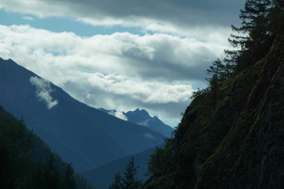 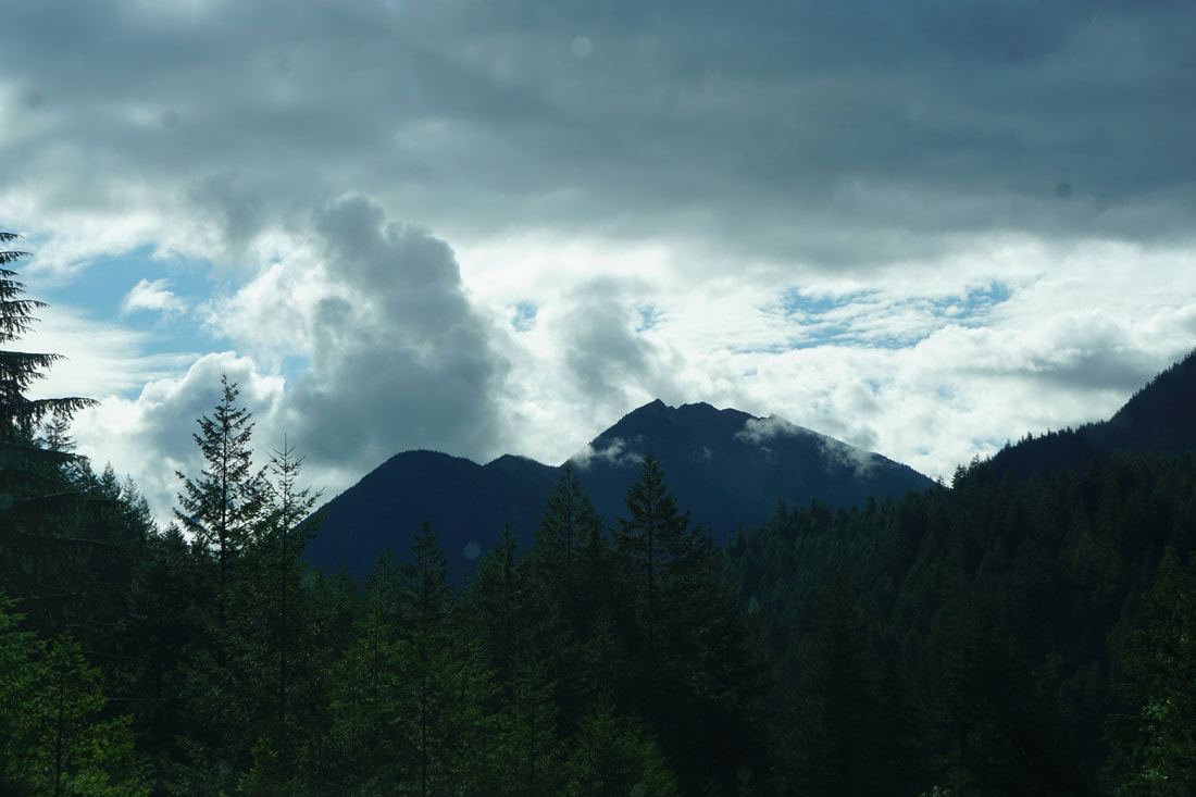 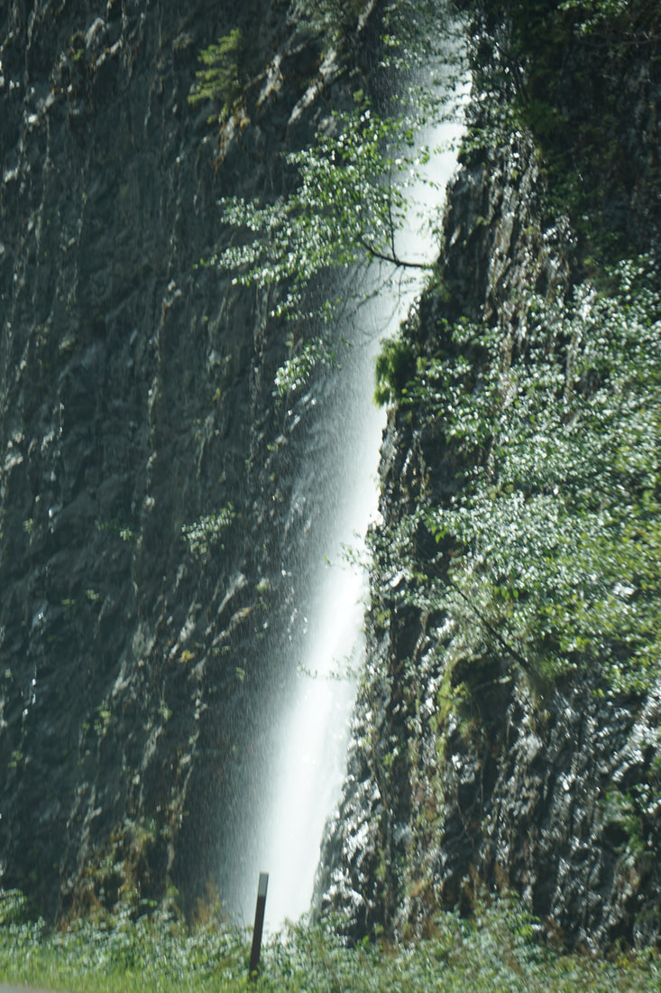 At Washington Pass (5477 feet) we stopped to walk the overlook path and had a good view of the North Cascade Mountains. Ragged and jagged, they have a different look than previous mountain ranges we have seen. 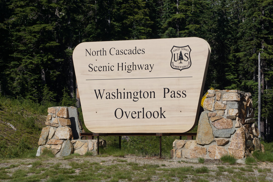 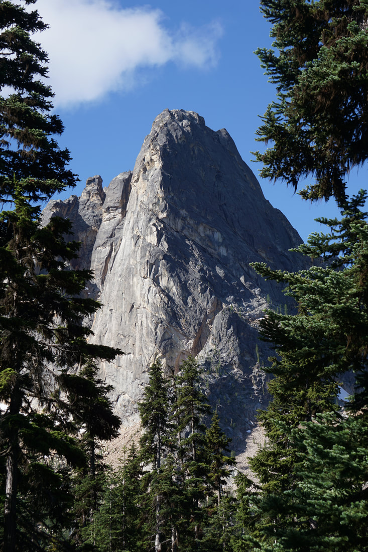 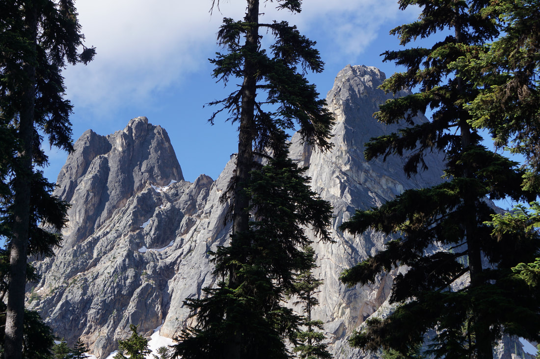 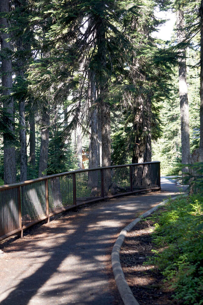 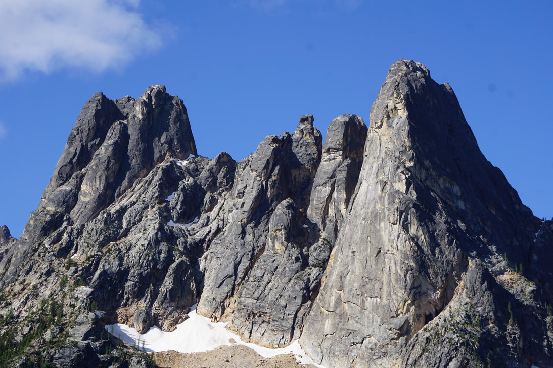 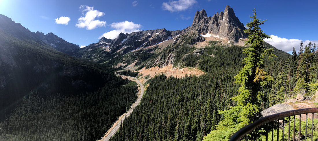 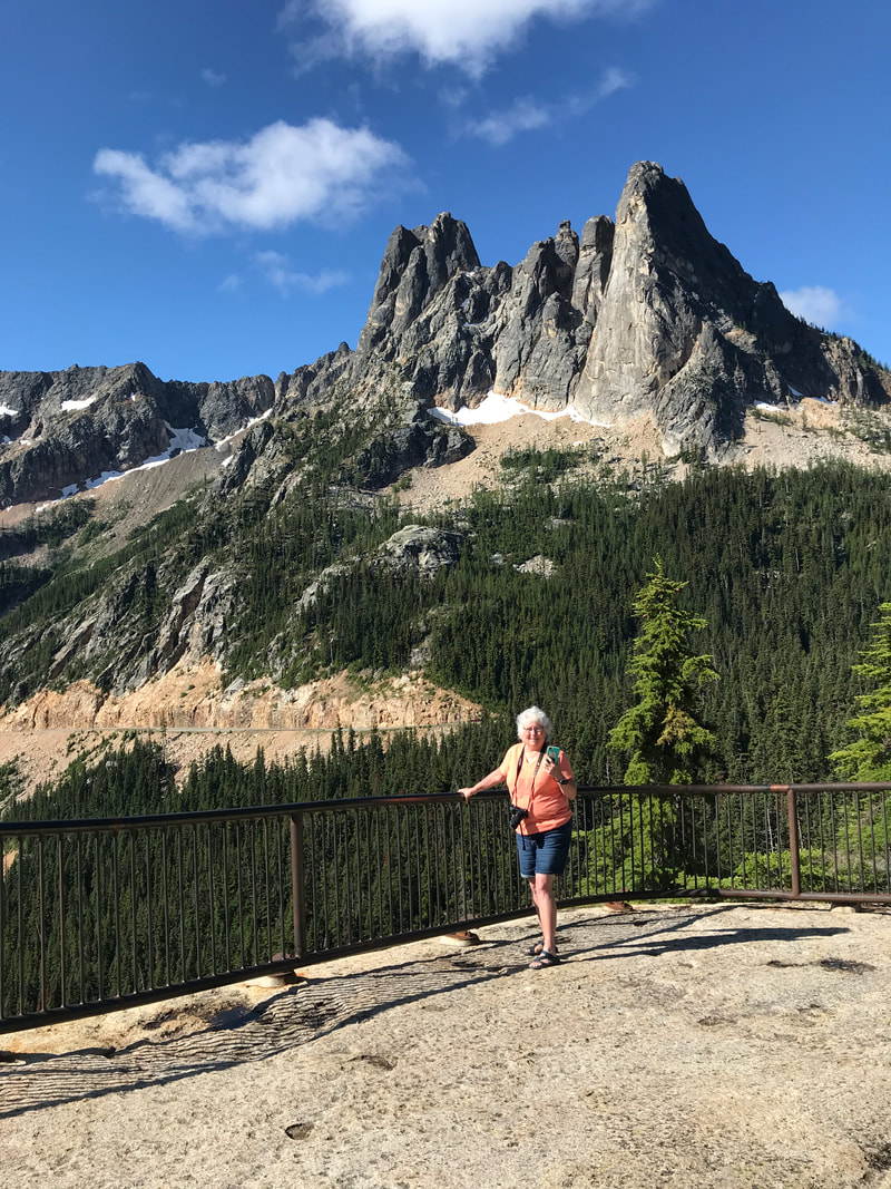 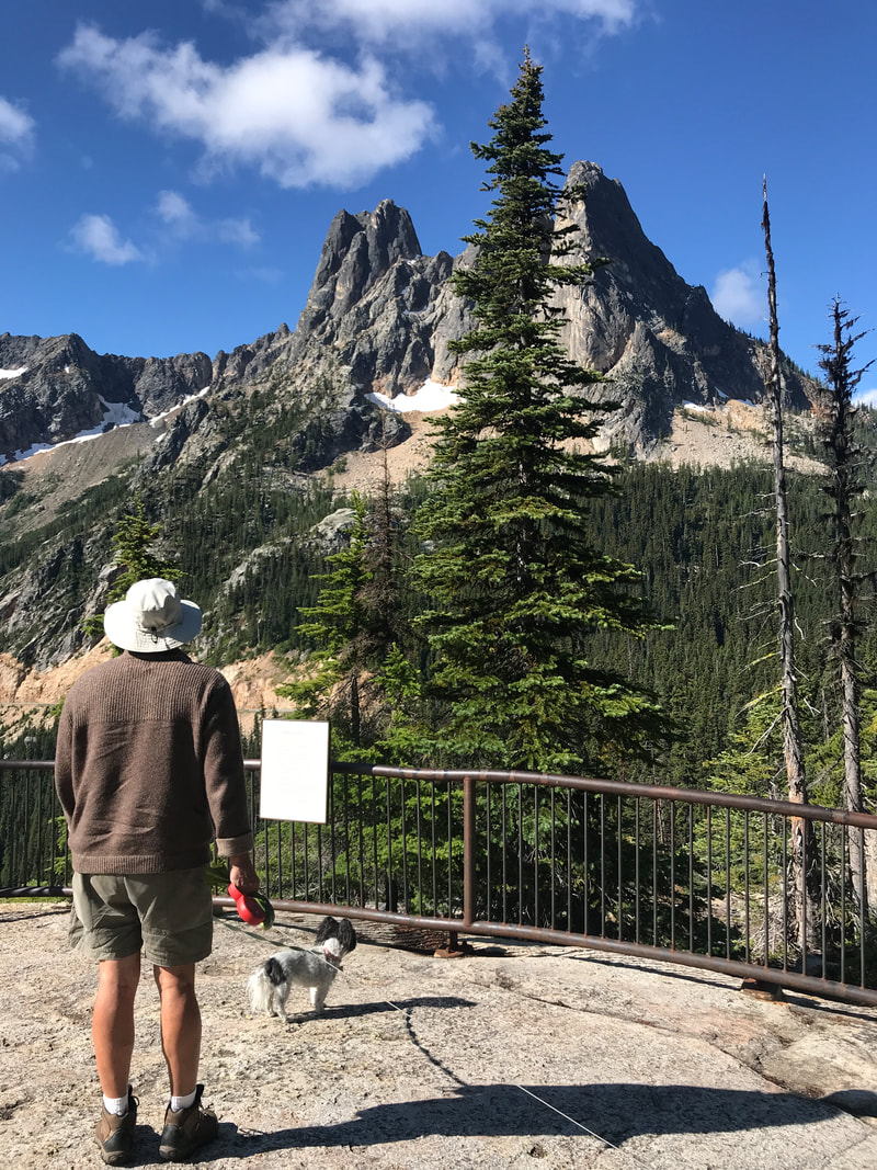 At Washington Pass we also had a good view of the road that we would be taking! As we drove the road, we could look back up at the overlook! 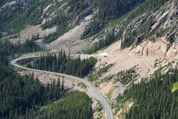 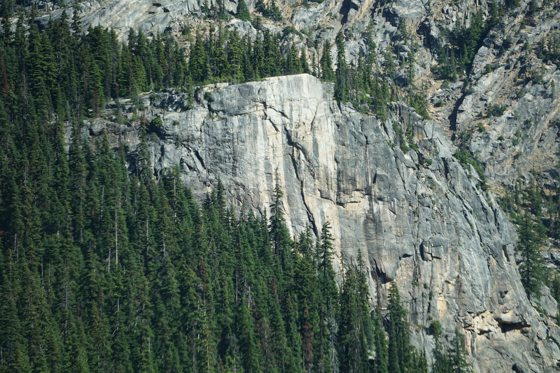 As we left the National Park we kept our eyes open for a Laundromat; first two (small) towns were a wash-out (pun intended), but the third town of Okanagan had one. Then, it was just 30 miles into Bridgeport State Park. All along the way were groves of apple trees. It must be about picking season because large crates were stacked along the road, and it appeared that migrant workers/pickers were in the small migrant homes. 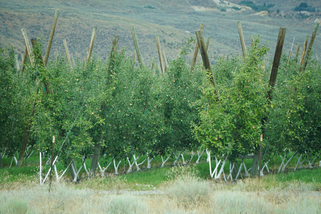 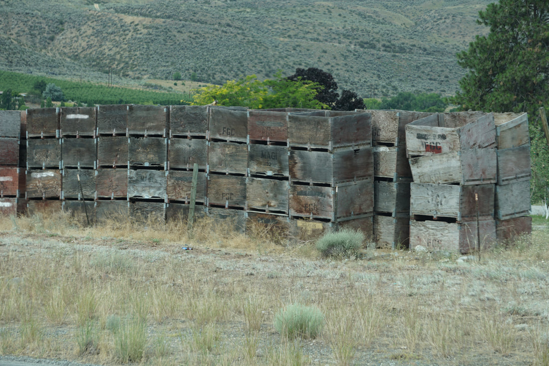 Our campsite had no services, but it was our first time on gorgeous grass in a long time. The dogs seemed to especially enjoy laying in the shade of the big trees and enjoying the cool grass. The only drawback is that we were warned by the park ranger to watch for rattlesnakes.  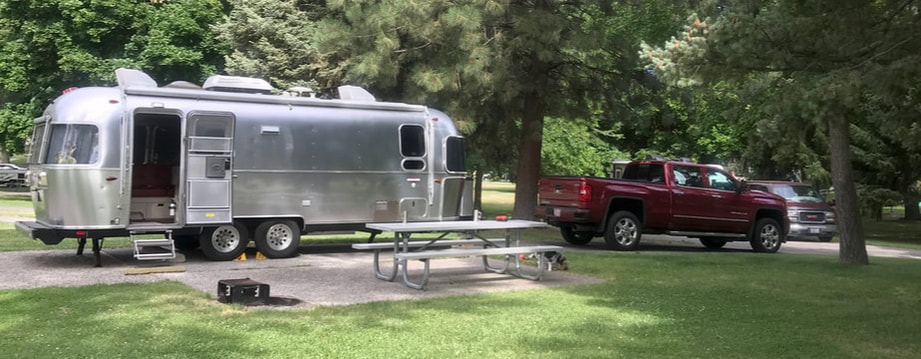 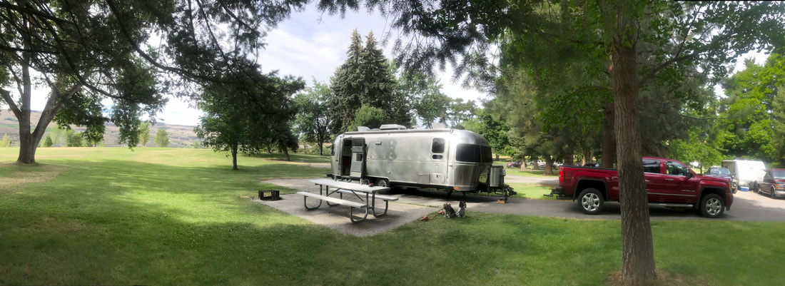 There is an unusual form of rocks called “haystacks” littering the park; they are gigantic volcanic formations that were spewed from a volcano in Idaho millions of years ago and traveling several hundred miles to get here! Some are the size of a house, and many the size of our trailer and some smaller. 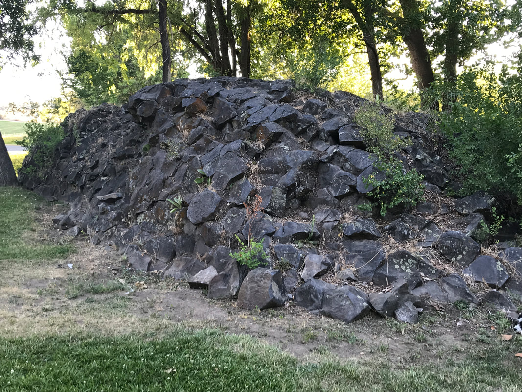 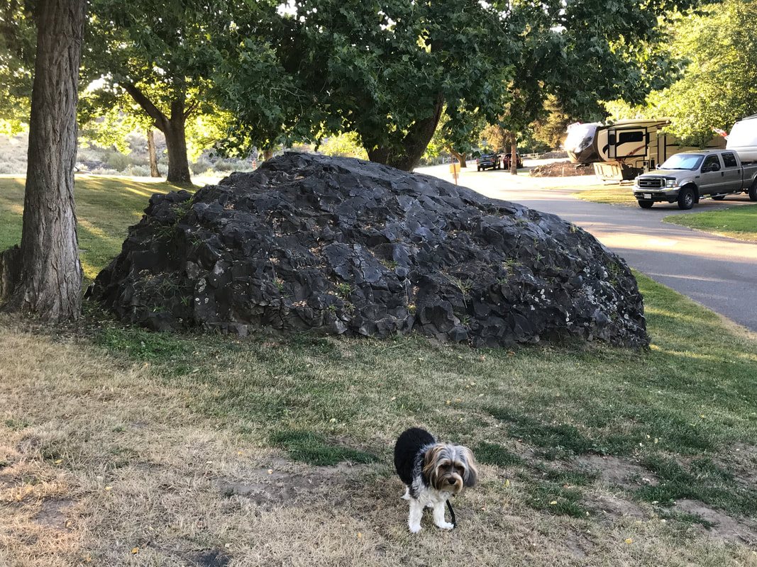 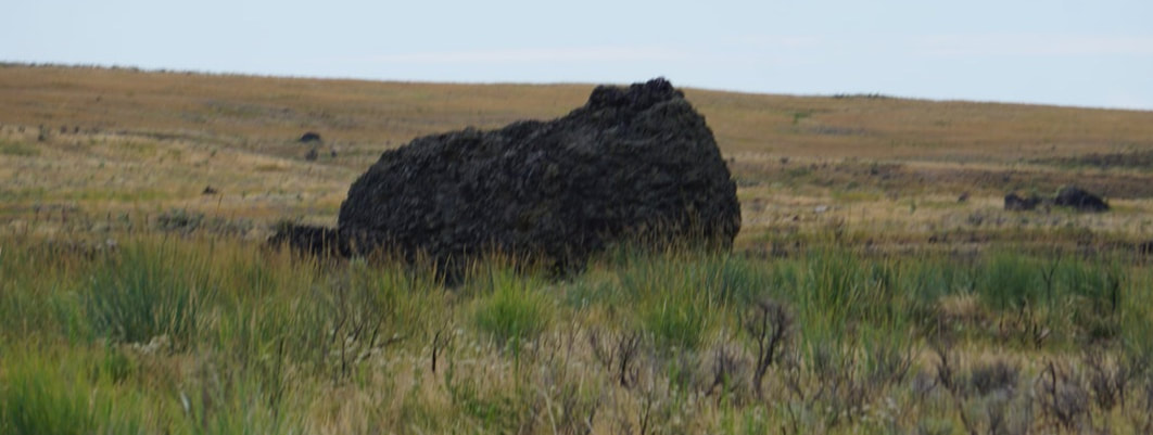 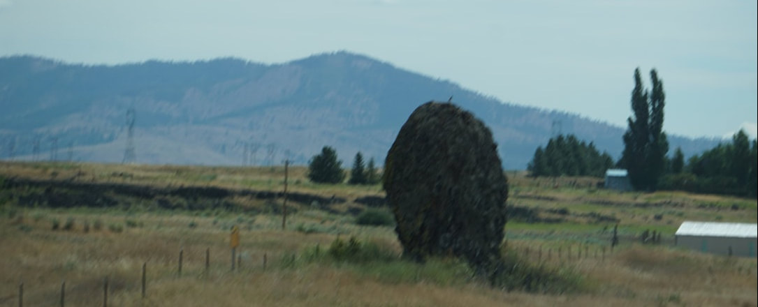 Right by the park is the Chief Joseph Dam and we drove down to view the spillway lookout and the dam overview. The visitor center was closed so we did not hear the story of the dam and why it was named after Chief Joseph, but we do know the story of Chief Joseph who led the last hold-out Indians in the great Indian wars. 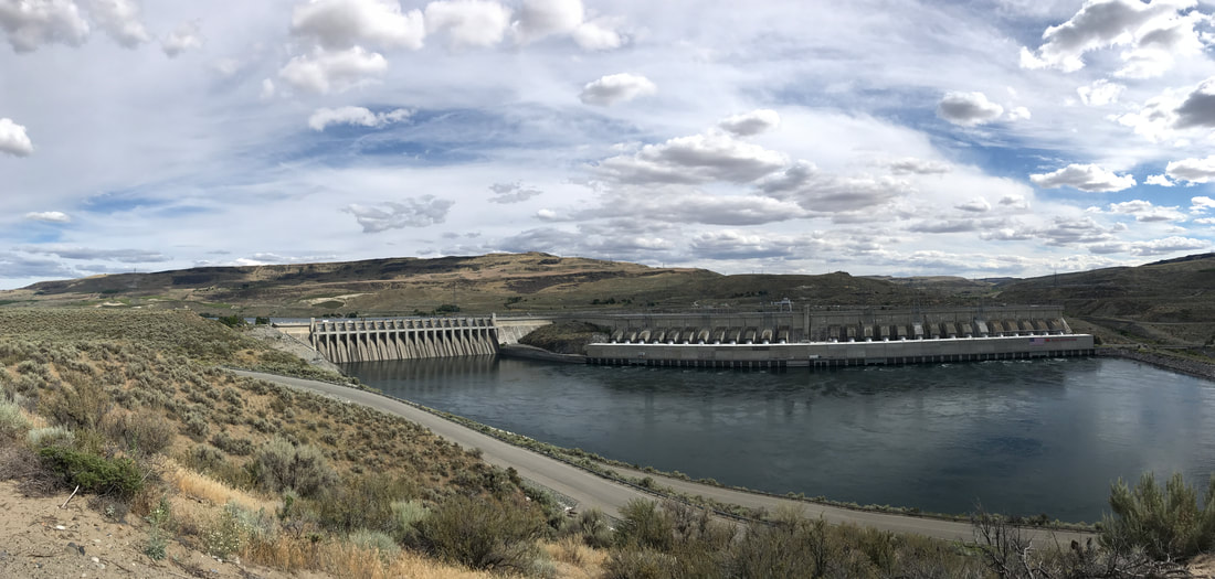 Dinner was grilled hamburgers. During the evening we sat out and enjoyed books.
Wednesday, July 10 Everything was dripping this morning; the treetops give so much protection that it could be pouring and only a few drips would find their way to the ground! Our first stop was at the visitor’s center where Tom talked to the ranger about hikes. North Cascades offers one road – Route 20 – going through the park with stops about every 5-10 miles.  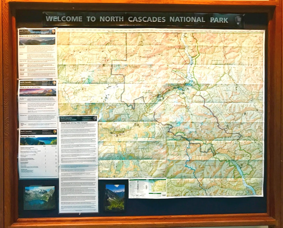 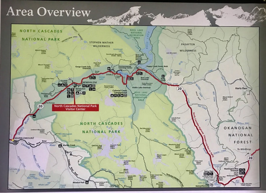 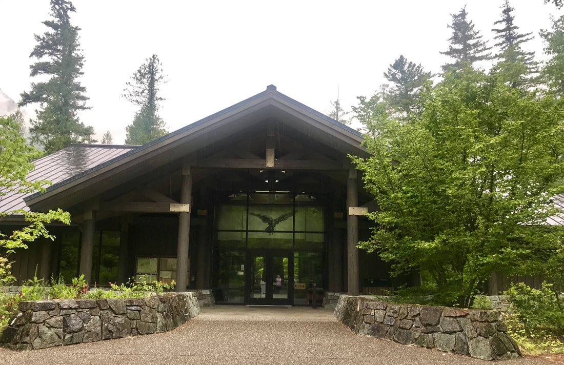 Starting out was the Seattle Lights Electric Company that furnishes electricity to Seattle. The electric company/power plant itself maintained a nice trail along the Skagit River, and Ladder Falls, and maintained wildflower gardens. 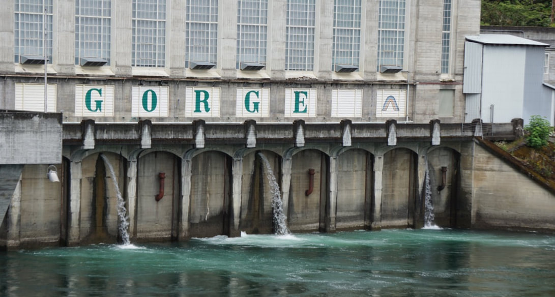     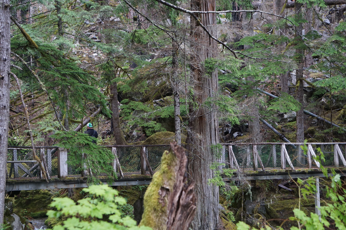  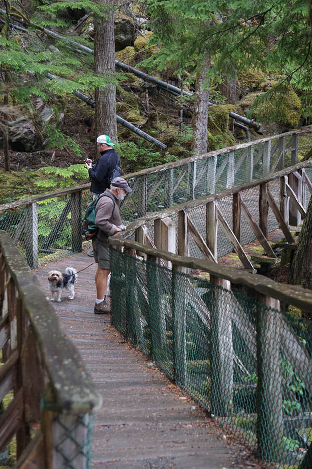 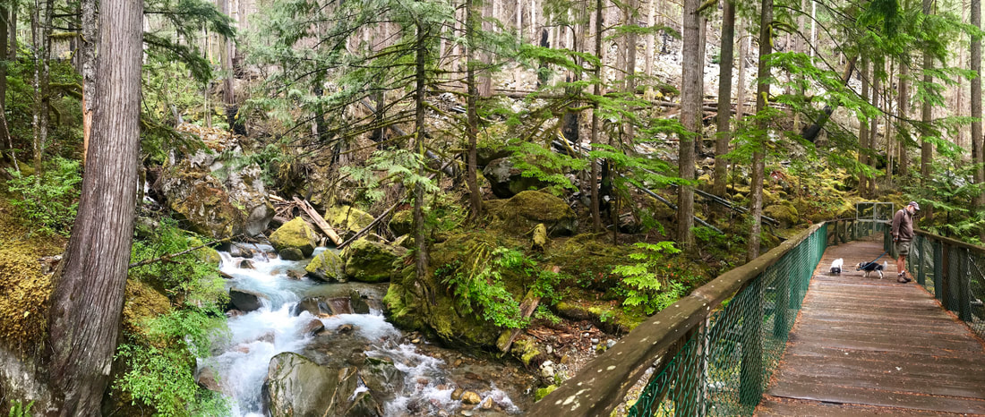 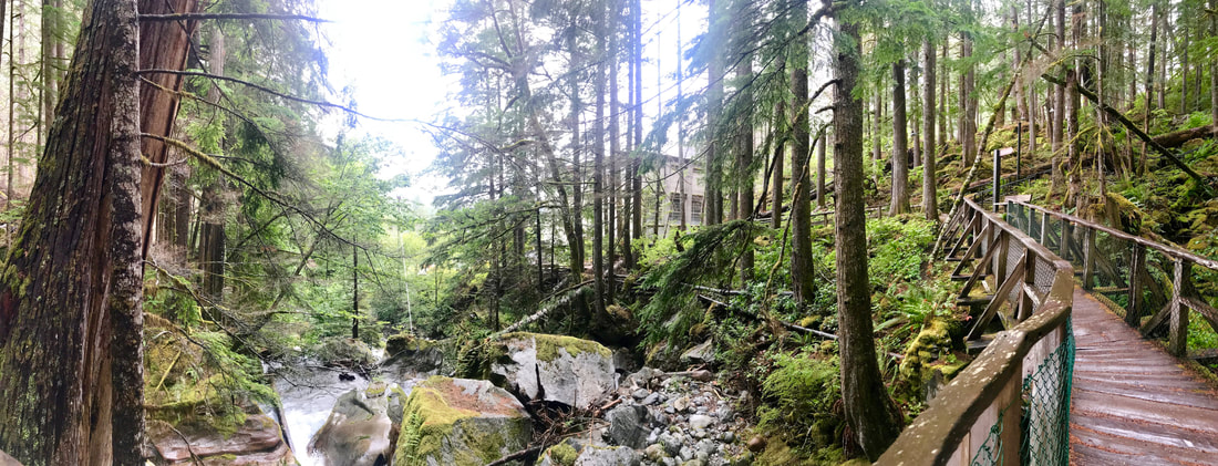 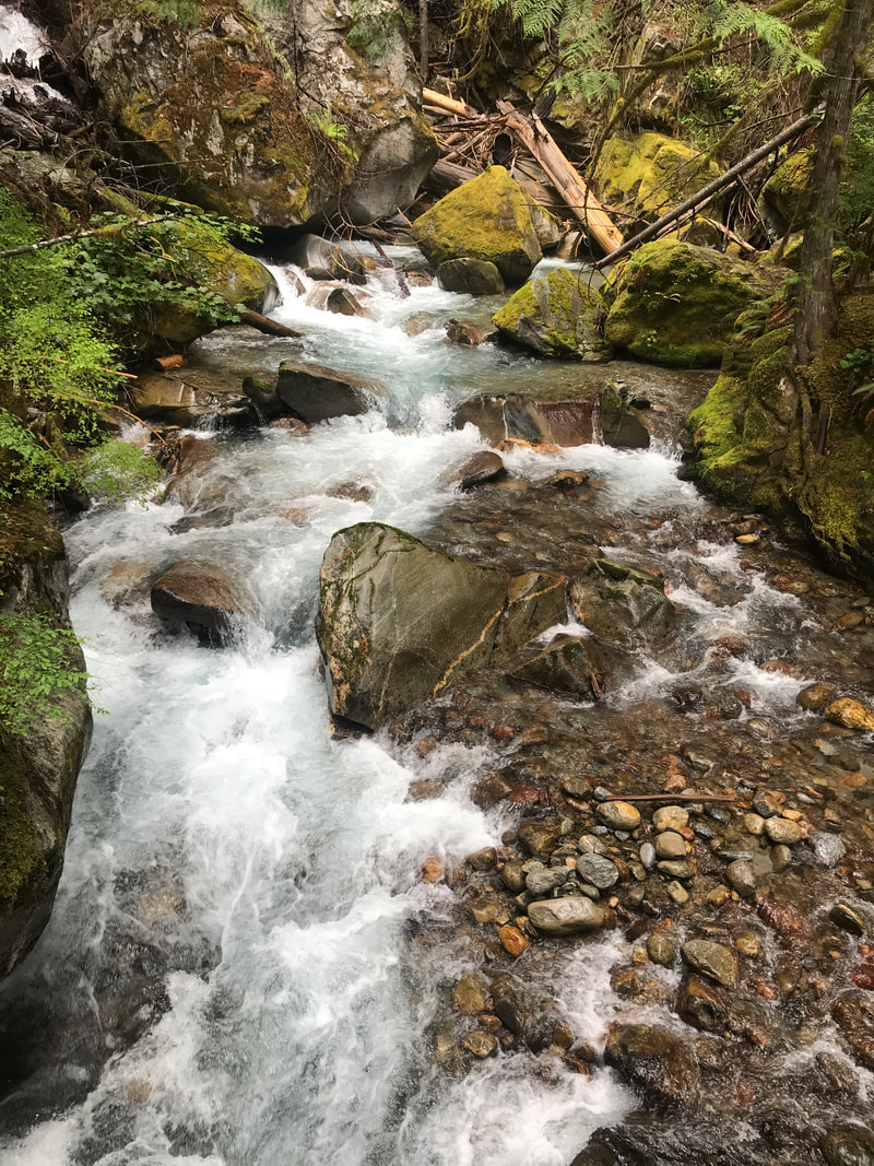 Two miles down the road was the Gorge Dam, with another wooded walkway that went up the mountain to several overlooks. 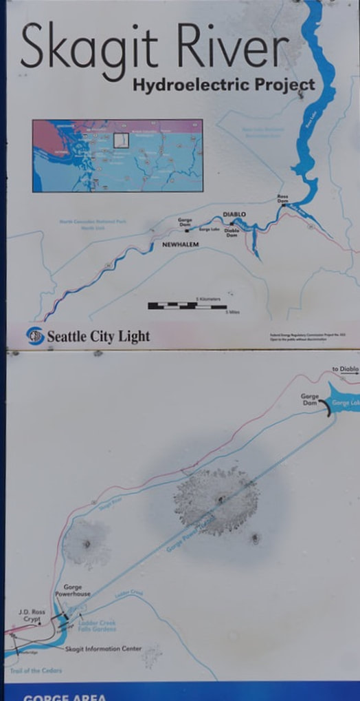  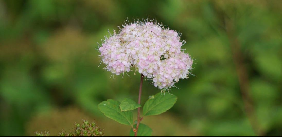  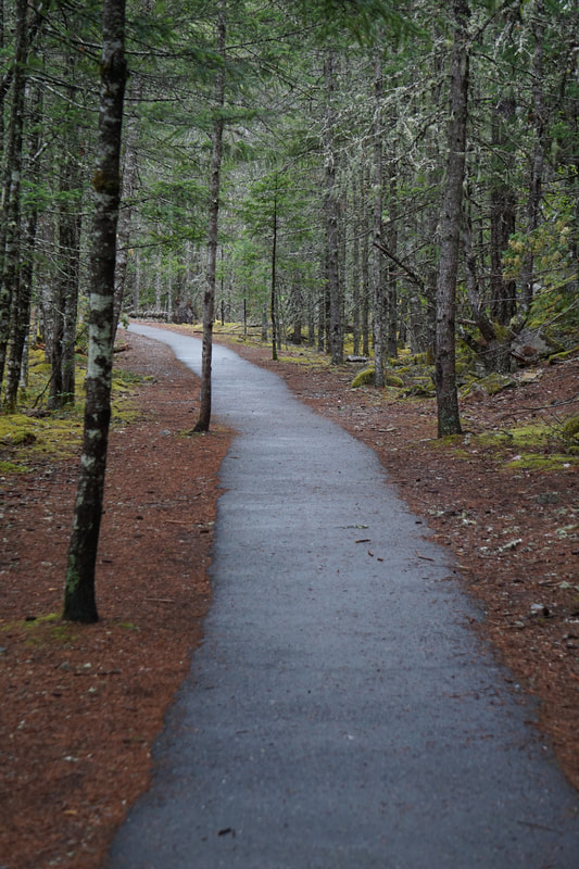 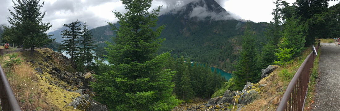 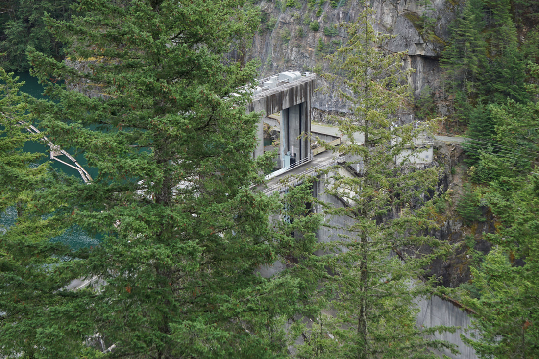  On the way to our next viewing point we saw a car stopped in the middle of the road. This could only mean one thing . . . . BEAR! 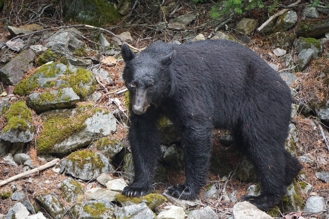 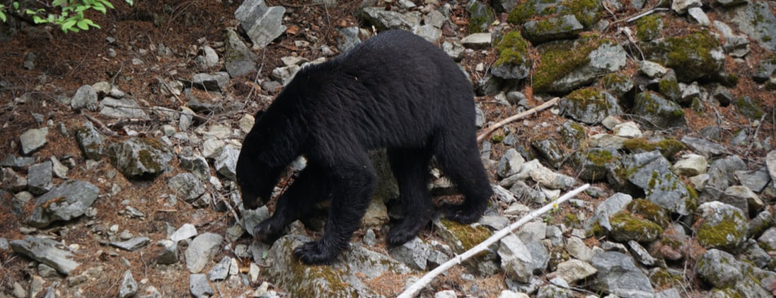 Another eight miles down the road was Diablo Lake and Dam Overlook. Ross Lake was another overlook but, we didn’t stop. All of these lakes are a result of a series of Dams on the Skagit River. The drive today was one that we will take with the trailer when we hook up and leave tomorrow, and it was nice to scope it out before towing through the gorge! 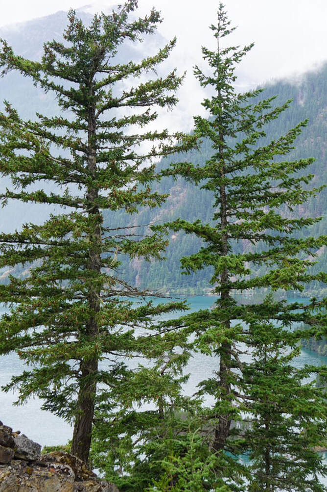 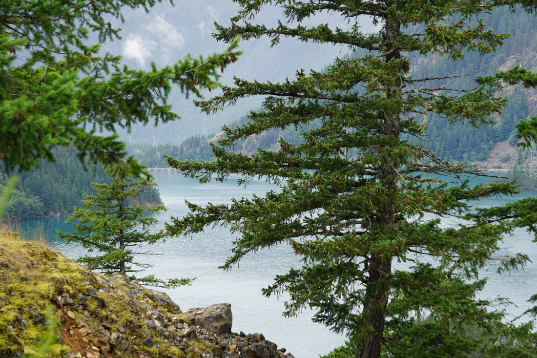 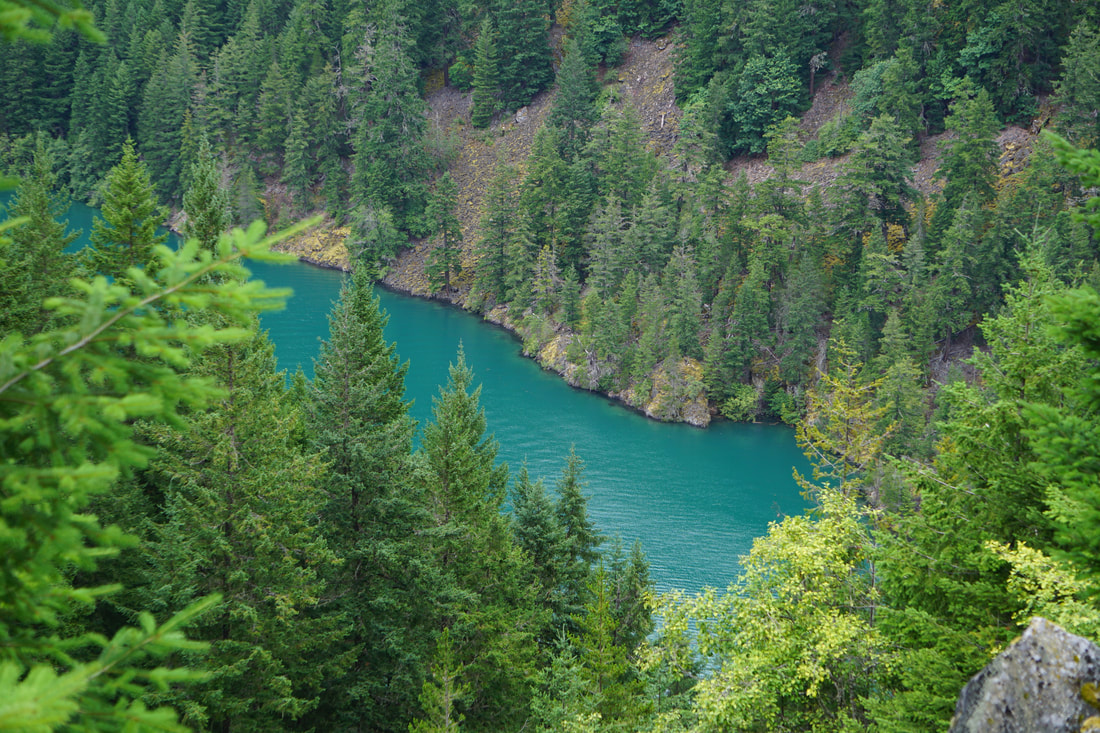 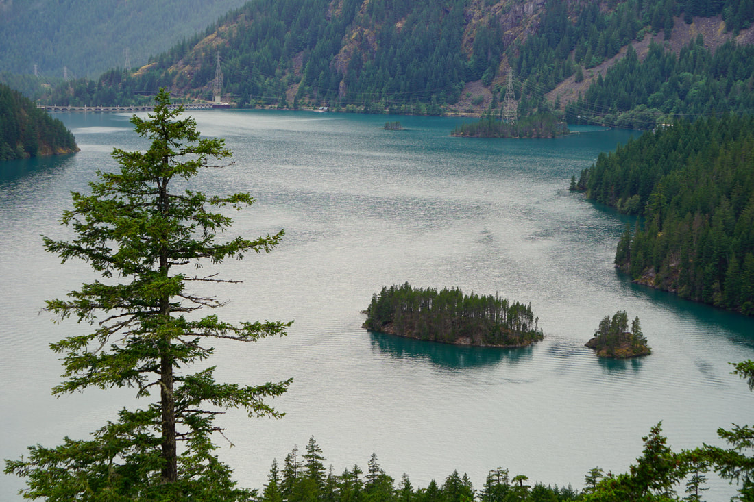 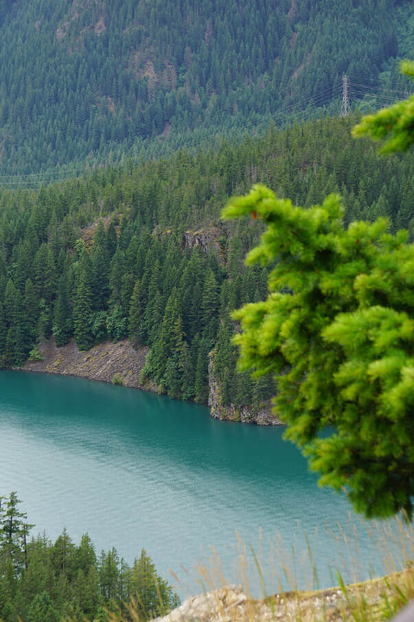 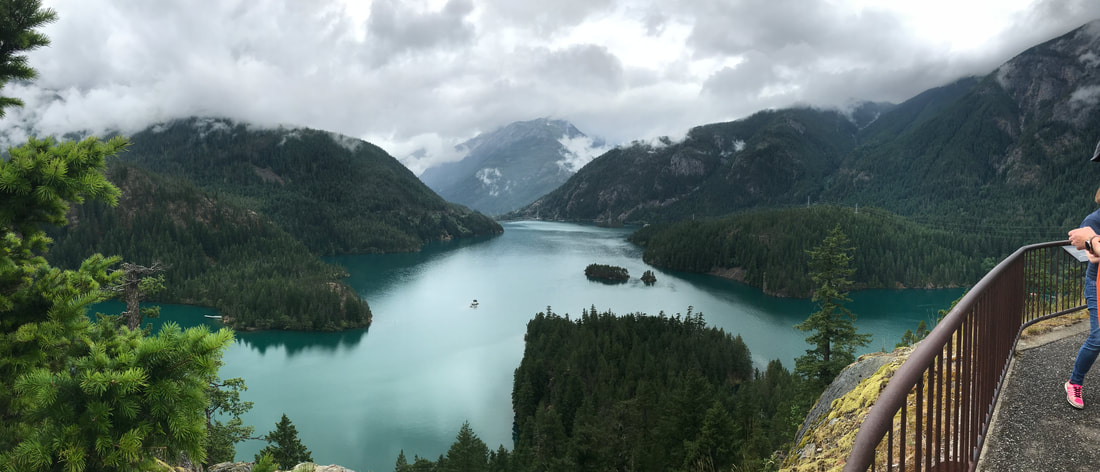 All of this took place on an overcast day, sometimes spiting rain, with temperatures in the mid 60s. Not wanting to grill out in the drippy campsite, we headed into the little town of Marblemount, 12 miles away, to the Buffalo Run Restaurant. I should have taken a picture of the menu – Camel, Yak, Elk, Emu, lamb, and beef burgers. We settled for the Buffalo! 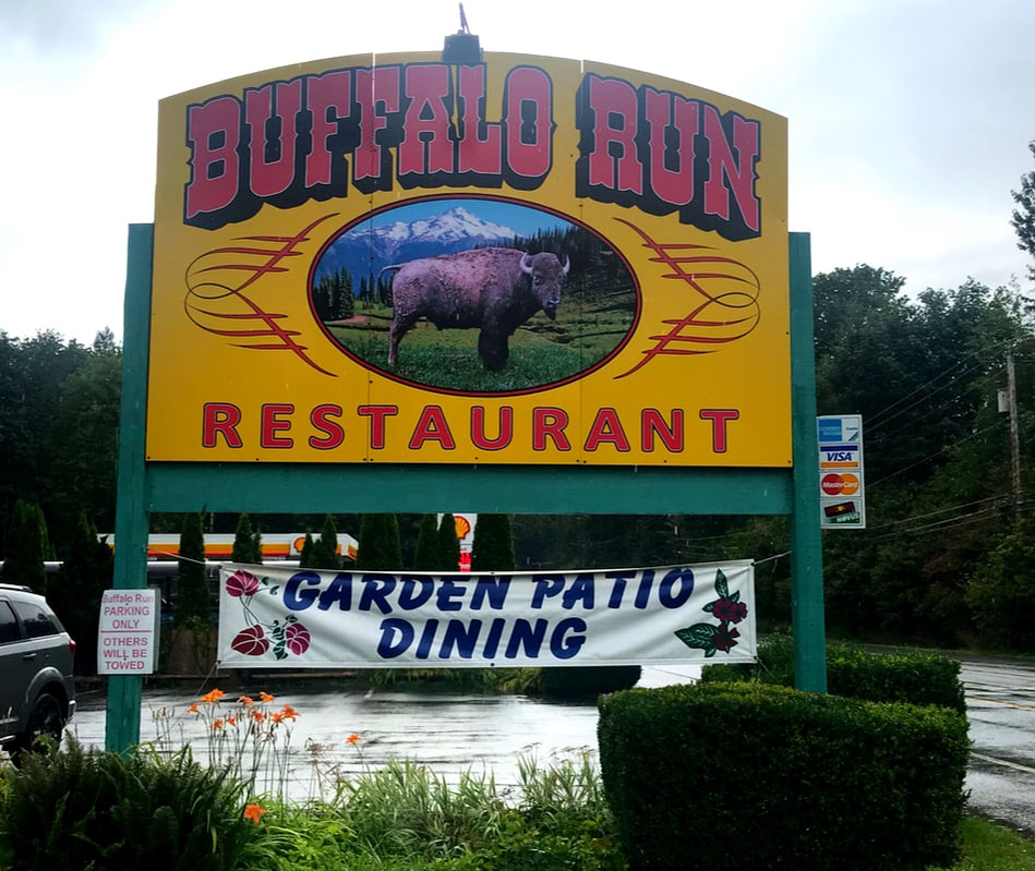 Tuesday, July 9, From now on, most of our travels will be steadily EAST! Not enough that we feel we are on the final trek yet . . . we still have several significant stops . . . but we are preparing for the inevitable homeward bound trip in the next two weeks. Today we veered off our route just a little bit to see my first Cousin Marianne Kintner Everett, daughter and husband Karen and Greg, and their daughter, Zoey. The Kintner Cousins are liberally sprinkled across the USA, and it is not often that we are afforded the opportunity to meet. We could/should have put more effort into arranging meet-ups, but our daily schedule of driving, reservations, and sight-seeing doesn’t leave much wiggle room. Our lunch, at Arnies in the town of Edmonds along the Puget Sound, was very meaningful for me. Afterwards, I vowed that the next time we come out to this area we will make more advance plans to spend more time with more cousins! We only got this one picture! 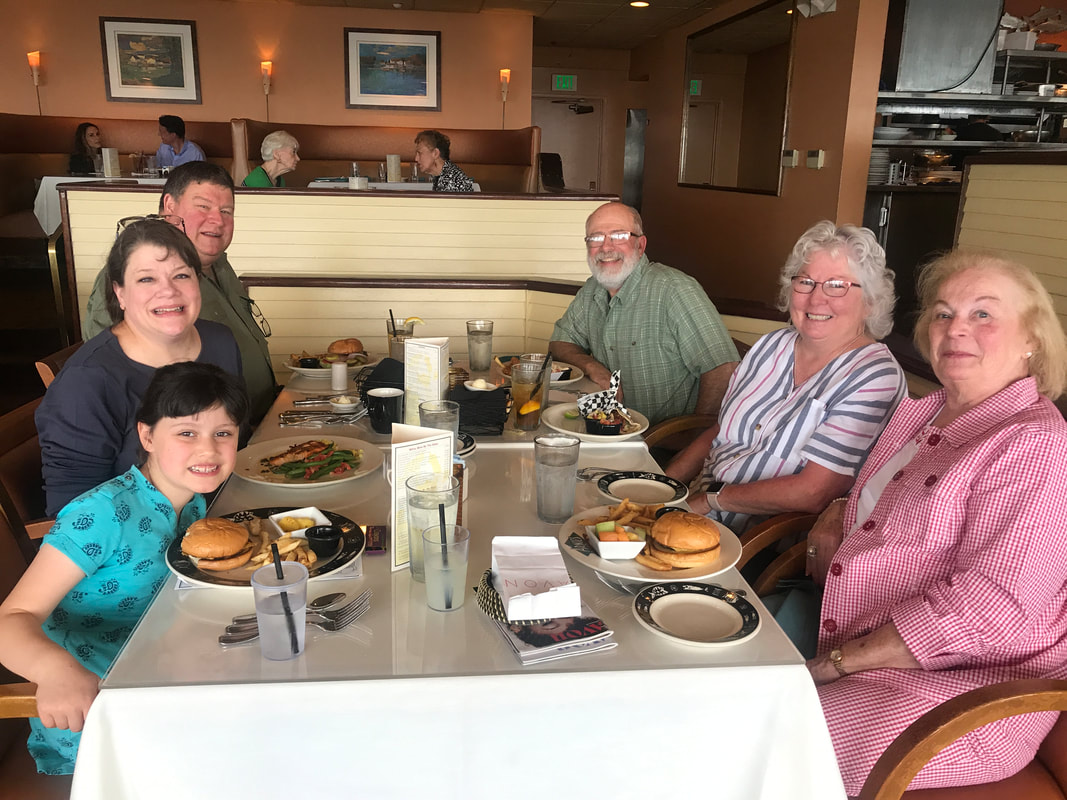 We had another 3 hours to drive to the North Cascades National Park, Newhalem Campground. By 5:30 we set up and by 6:00 we had a supper of hamburgers. We then went on our little customary scouting trip to check out the area. The visitor center and the General Store were both closed – but we found the Trail of the Cedars that we though would be nice for an evening walk for the dogs. It began by crossing the Skagit River and then was a wide, level, well-narrated loop path around a forest grove. 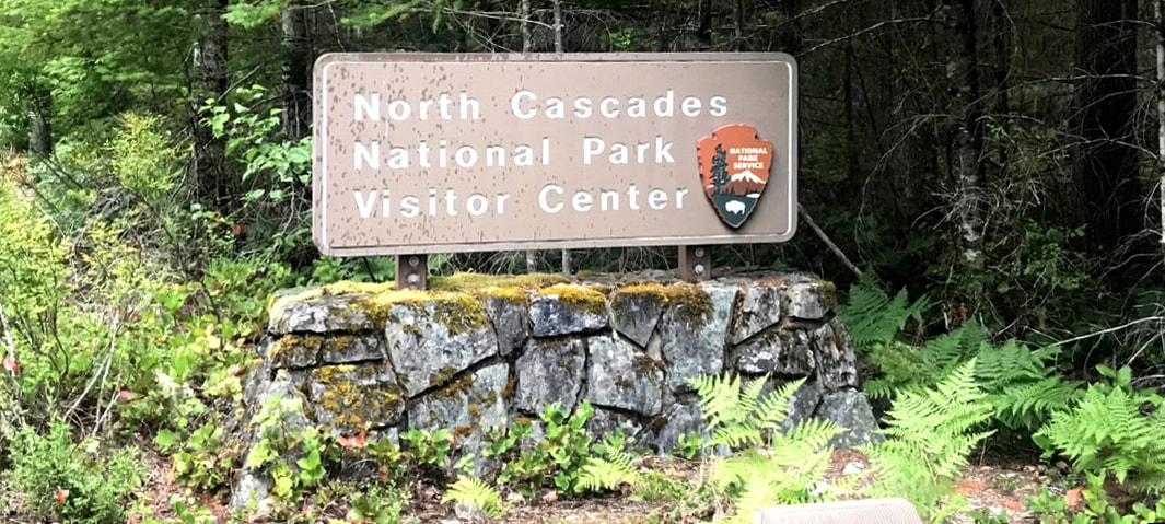 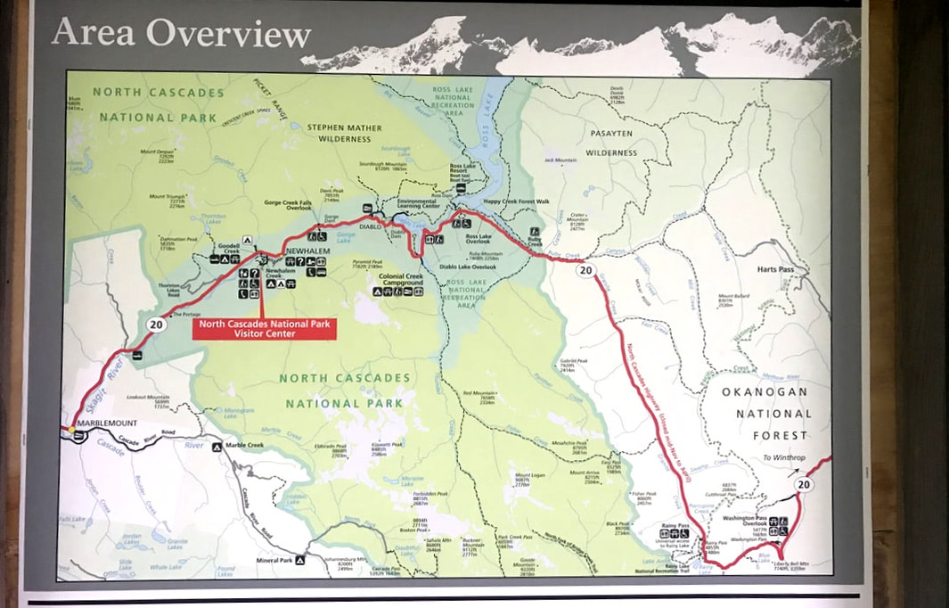  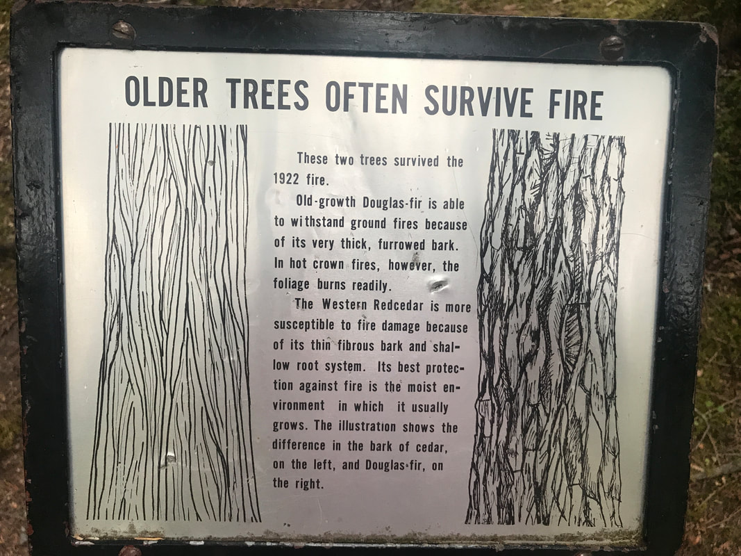 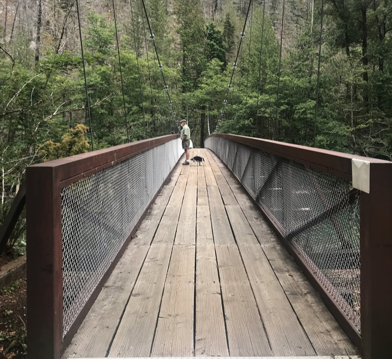 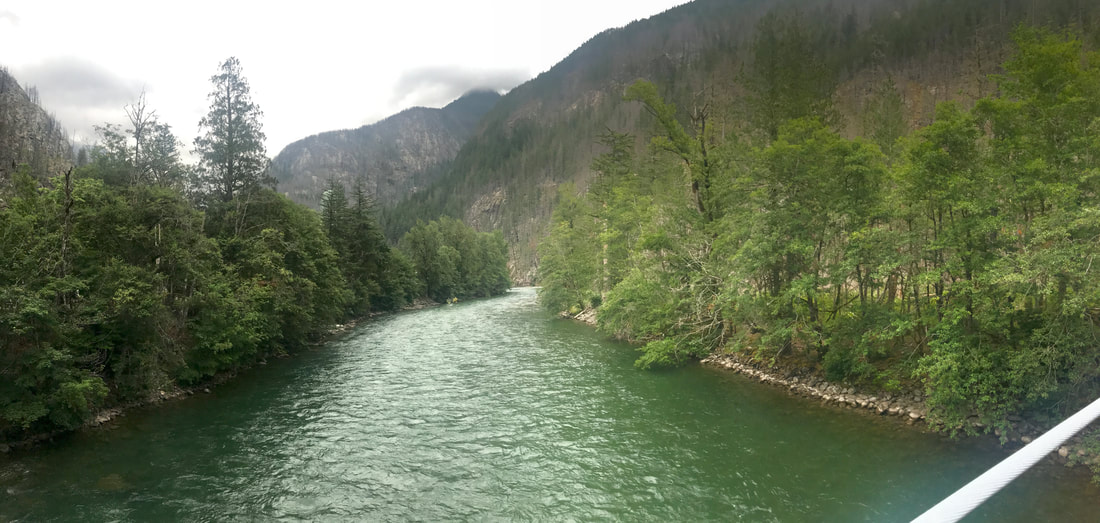 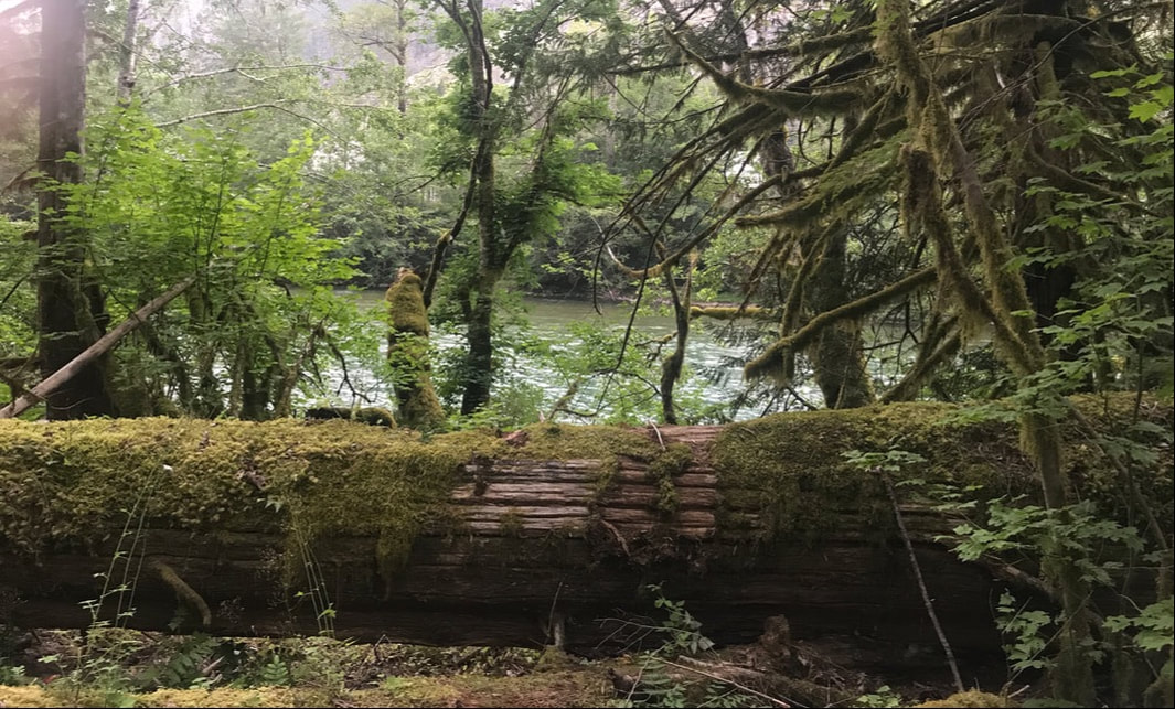       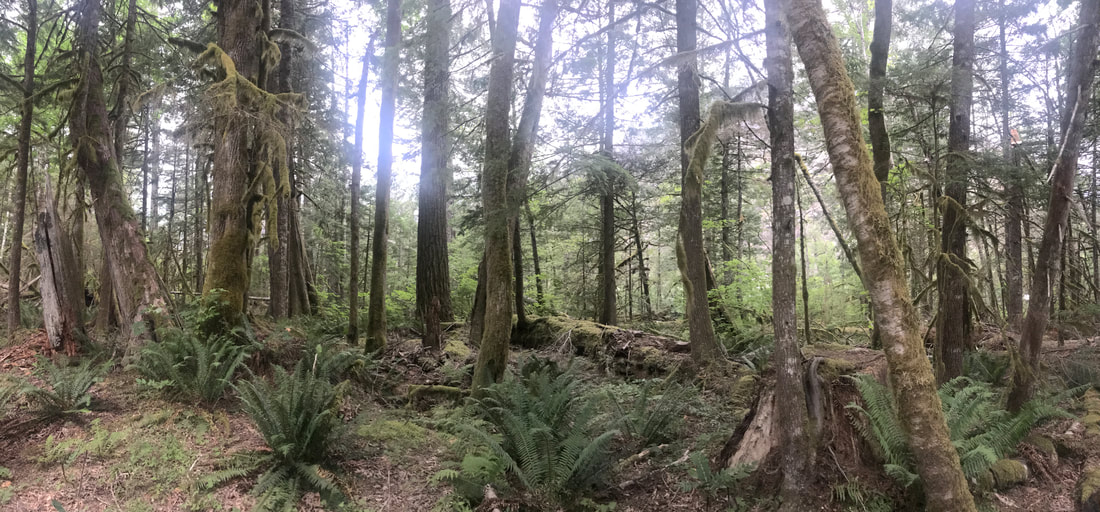 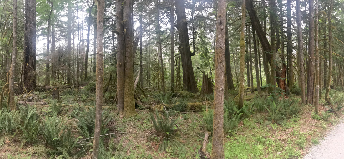 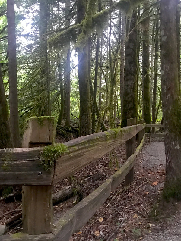 We heard the patter of light sprinkles on the roof of the Silvermine . . . all night long.
|
